place

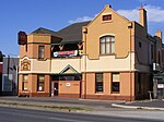
Pooraka railway station

1987 disestablishments in AustraliaDisused railway stations in South AustraliaRailway stations closed in 1987Railway stations in Australia opened in 1913

Pooraka railway station was located approximately 12.9 km by rail from Adelaide on the former 3.9 kilometres (2.4 mi) long Northfield branch line that opened in June 1857. The station opened as Abattoirs railway station on 12 July 1913, when the adjacent Gepps Cross Abattoirs also opened. The station's livestock sidings extended for most of the 970 metres (1060 yards) of the line between Port Wakefield Road and the Gawler Road (later Main North Road).

Excerpt from the Wikipedia article Pooraka railway station (License: CC BY-SA 3.0, Authors).

Pooraka railway station
Matthews Road, Adelaide Gepps Cross

Geographical coordinates (GPS) Address Website Nearby Places
placeShow on map

Wikipedia: Pooraka railway stationContinue reading on Wikipedia

Geographical coordinates (GPS)

Latitude Longitude
N -34.8356 ° E 138.608 °
placeShow on map

Address

Gepps Cross Shopping Centre

Matthews Road
5094 Adelaide, Gepps Cross
South Australia, Australia
mapOpen on Google Maps

Website

linkVisit website

Share experience

Nearby Places

Gepps Cross, South Australia

Gepps Cross (pronounced 'Jepps Cross') is a suburb and major road intersection in the north of Adelaide, South Australia. Gepps Cross is traditionally seen as the end of the inner suburbs and the start of the outer northern suburbs, as it was home to a major abattoir (now closed and demolished) with holding yards and other open space. It is the first significant open space encountered after the North Parklands. It retains the open nature, even with warehouses, a velodrome, hockey stadium, Adelaide Raiders – a Croatian soccer club, and karate training facilities. Gepps Cross is best known for the five-way intersection with Grand Junction Road going east and west, Main North Road south and north-east, and Port Wakefield Road going north. The intersection is not grade-separated. It is controlled by traffic lights, and all five roads have at least three lanes in each direction. These roads include the main highways from Adelaide to Western Australia and the Northern Territory (via Port Wakefield Road), New South Wales (via Main North Road), the northern suburbs of Adelaide and the northern parts of South Australia (both roads). Port Adelaide is to the west, and the major freight hubs are northwest of Gepps Cross. A major route from Port Adelaide towards Victoria and the south and east of South Australia is east along Grand Junction Road then south along Portrush Road to the South Eastern Freeway. It was a holding place for people that came from England in 1952; from there they went interstate to find new homes.