place

Hinxworth Place

Country houses in HertfordshireGrade II* listed buildings in HertfordshireGrade II* listed housesManor houses in EnglandNorth Hertfordshire District
Hinxworth Place morning

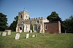
Hinxworth Place is a medieval manor house near Hinxworth, Hertfordshire, England. Formerly the Manor of Pulters, building was started c. 1390. The construction is of clunch with loose flint filling cavities in the lower part of the walls. There is 16th century decoration painted directly onto the stonework in one of the upper rooms. It was once owned by John Ward, son of Richard Ward, who was Lord Mayor of London for one month in 1484. After his death it passed to John Lambard, master of the Mercers' Company and alderman of London.The house was inhabited at one time by Cistercian monks of Pipewell Abbey in Northamptonshire. The Drury and Andrews map of 1766 shows an L shaped building with three separate outbuildings with indication of an avenue and other plantings.The large spring fed pond to the south of the house is one of the sources of the river Rhee which is a major tributary of the river Cam. In the early part of the 20th century it was owned by Walter Sale who farmed 250 acres (1.0 km2) but in the 1930s was compulsorily purchased by the county council who divided the land into four smallholdings each of about 60 acres (240,000 m2). The Sales remained tenants until 1949 by which time, the house having fallen into dereliction, it was sold to a banker who formed a syndicate of London professionals and artists (including the actor Peter Copley) who renovated it.Hinxworth Place was divided and sold during the 1960s and the larger part of the property is now the home and workplace of the sculptor John W Mills, a number of his works are displayed in the grounds.

Excerpt from the Wikipedia article Hinxworth Place (License: CC BY-SA 3.0, Authors, Images).

Hinxworth Place
New Inn Road, North Hertfordshire

Geographical coordinates (GPS) Address Website External links Nearby Places
placeShow on map

Wikipedia: Hinxworth PlaceContinue reading on Wikipedia

Geographical coordinates (GPS)

Latitude Longitude
N 52.04133 ° E -0.19492 °
placeShow on map

Address

Hinxworth Place

New Inn Road
SG7 5HG North Hertfordshire
England, United Kingdom
mapOpen on Google Maps

Website
britishlistedbuildings.co.uk

linkVisit website

linkWikiData (Q5767761)
linkOpenStreetMap (2183698867)

Hinxworth Place morning
Share experience

Nearby Places

Church of St Nicholas, Hinxworth

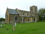
The Church of St Nicholas is a Church of England parish church in the village of Hinxworth in Hertfordshire and is a Grade II* listed building dating mostly to the 14th century. The church comes under the Diocese of St Albans.The church is dedicated to St Nicholas and almost certainly stands on the site of an earlier church; however, there is no mention of a priest at Hinxworth in the Domesday Book. The West tower and battlemented nave are 14th century with 15th century alterations and are built of flint rubble with clunch dressings. The chancel, which was rebuilt in about 1830, is of early 19th-century red brick chequered with stone dressings. The tower is in two stages with angle buttresses and battlements. The gabled South porch dates to the 15th century. The chancel measures 20 ft. by 16 ft., the nave 42 ft. 6 in. by 20 ft., the west tower 10 ft. 6 in. square, and the south porch 12 ft. by 10 ft.St Nicholas' has an aisleless nave with a late 19th-century panelled roof supported on four 15th-century carved wooden corbels. In the splay of the North nave window and in the south-east corner of the nave are two unusual canopied niches. Beside the north window is a 14th-century spiral staircase, now blocked at the top, which originally led up to the now lost rood screen. The west arch is of about 1350 and has semi-octagonal shafts. The original chancel arch was demolished in about 1440 and a mis-shaped replacement was built about 2 ft further east. The clerestory was raised at the end of the 15th century, and a new low-pitched roof was installed above it. The chancel has a panelled ceiling with simple bosses, while the stained-glass windows are mid-19th century.Two monumental brasses can be found in the chancel, with that high on the north wall being mid-15th century and believed to be the figures of Simon Ward, 1453, and his wife, 1481; that on the floor of a man, woman and six children is said to be of John Lambard, Alderman of London (died 1487), the eldest daughter was supposedly Elizabeth (better known as Jane Shore, mistress of Edward IV of England). The pulpit is mid-18th century with fielded panels, near which is a 16th- or early 17th-century Rector's chair. The small octagonal baptismal font in the west is mid-19th century. There are six bells with the treble by Mears & Stainbank (1908); the second by John Briant of Hertford (1820); the third and fourth by Miles Graye (1651); and the fifth and tenor by John Briant (1825 and 1820). These bells and the tower were restored between 1981 and 1986 with money given in response to a BBC Radio Appeal by author Monica Dickens, who had lived in the village before her marriage, and with funds raised by the Friends of the Church. The church has been Grade II* listed since May 1968.

Caldecote, Hertfordshire

Caldecote is a village and civil parish in the North Hertfordshire district of Hertfordshire, England. It is located around three miles north of Baldock and around a mile and a half east of Stotfold in the neighbouring county of Bedfordshire. The Great North Road passes just to the west of the village. Caldecote forms part of the Caldecote and Newnham grouped parish council, which covers an area of only 325 acres (1.32 km2). The village consists of a cluster of cottages around the redundant Church of St. Mary Magdalene, which dates from the 14th and 15th centuries and is in Perpendicular style. The church is currently in the care of the Friends of Friendless Churches charity.To the south of the church is a manor house dating from the 14th century. In the year 1724, several Roman urns, containing burnt bones and ashes, were discovered in this parish. During the 1970s archaeological excavations were carried out for a number of summers under the direction of Professor Guy Beresford. These revealed that during the 12th and 13th centuries there were approximately nine crofts lying to the north of the church and possibly three others close to the northwest boundary of the present manor garden. The population declined heavily during the mid-14th century, mainly due to the Black Death; no subsidy was paid in 1428 indicating that by then there were less than ten householders. The excavations demonstrated that after the manor was granted to the Priory the lands of the peasantry were gradually amalgamated.