Toddbrook Reservoir

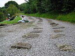
Toddbrook Reservoir, a feeder for the Peak Forest Canal, opened in 1838. It is above the town of Whaley Bridge in the High Peak area of Derbyshire, England. The reservoir is a Site of Special Scientific Interest (SSSI) providing habitats for herons, ducks and other animals and fish, while rare mosses and liverworts grow on its shores, particularly short-lived species that grow on seasonally exposed mud. The reservoir is used for sailing and angling. The Peak District Boundary Walk runs around the eastern end of the reservoir. The reservoir is owned by the Canal & River Trust and, like the nearby Combs Reservoir, is a feeder reservoir for the Peak Forest Canal. The feeder runs through Whaley Bridge, and with the Combs feed enters the canal system in a pool close to the transhipment shed at the Whaley Bridge canal basin. The reservoir is fed from the Todd Brook, a stream which has a catchment area of around 1,700 hectares (4,200 acres) including the moorland on Shining Tor and farmland around Kettleshulme village. Water enters the reservoir on its north bank via a small waterfall. The first several inches of water do not flow into the reservoir but flow down the reservoir's run-off into the River Goyt. The reservoir often receives little or no inflow during periods when rainfall does not allow the level to exceed the barrier, and this often affects the reservoir's water level, particularly in the summer months. The reservoir's dam is built from earth with a puddle clay core. The embankment is straight in plan and approximately 310m long. The average crest level is 187.3 metres (615 ft) AOD. In August 2019, concrete panels on its spillway were dislodged after heavy rain, triggering the evacuation of parts of Whaley Bridge and the surrounding area due to the possibility of the dam collapsing.
Excerpt from the Wikipedia article Toddbrook Reservoir (License: CC BY-SA 3.0, Authors, Images).Toddbrook Reservoir
Reservoir Road, High Peak Hockerley
Geographical coordinates (GPS) Address Nearby Places Show on map
Geographical coordinates (GPS)
| Latitude | Longitude |
|---|---|
| N 53.325 ° | E -1.9936111111111 ° |
Address
Reservoir Road
Reservoir Road
SK23 7BW High Peak, Hockerley
England, United Kingdom
Open on Google Maps


