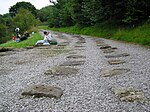
Shallcross, Derbyshire
High Peak, DerbyshireTowns and villages of the Peak DistrictVillages in Derbyshire
Shallcross is a small village in northwestern Derbyshire, England. It is located 15 miles (24 km) south of Manchester, at the edge of the Peak District, on the eastern side of the River Goyt. Located between Whaley Bridge and Fernilee, it is now administered as part of the larger community of Whaley Bridge. The area attracts many outdoors enthusiasts, especially hikers, because of the beauty and variety of the scenery. The country rises steeply as it ascends the Goyt Valley from the canal terminal at Whaley Bridge, past the Fernilee Reservoir, and onto the highlands of Axe Edge Moor.
Excerpt from the Wikipedia article Shallcross, Derbyshire (License: CC BY-SA 3.0, Authors).Shallcross, Derbyshire
Shallcross Road, High Peak Horwich End
Geographical coordinates (GPS) Address Nearby Places Show on map
Geographical coordinates (GPS)
| Latitude | Longitude |
|---|---|
| N 53.3155 ° | E -1.9792 ° |
Address
Shallcross Road
Shallcross Road
SK23 7EY High Peak, Horwich End
England, United Kingdom
Open on Google Maps


