Whaley Bridge
Civil parishes in DerbyshireHigh Peak, DerbyshireTowns and villages of the Peak DistrictTowns in DerbyshireWhaley Bridge

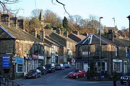
Whaley Bridge () is a town and civil parish in the High Peak district of Derbyshire, England. It is situated on the River Goyt, 16 miles (26 km) south-east of Manchester, 7 miles (11 km) north of Buxton, 9 miles (14 km) north-east of Macclesfield and 28 miles (45 km) west of Sheffield. It had a population of 6,455 at the 2011 census, including Furness Vale, Horwich End, Bridgemont, Fernilee, Stoneheads and Taxal.
Excerpt from the Wikipedia article Whaley Bridge (License: CC BY-SA 3.0, Authors, Images).Whaley Bridge
Canal Street, High Peak Hockerley
Geographical coordinates (GPS) Address Nearby Places Show on map
Geographical coordinates (GPS)
| Latitude | Longitude |
|---|---|
| N 53.3304 ° | E -1.9838 ° |
Address
Canal Street
SK23 7LS High Peak, Hockerley
England, United Kingdom
Open on Google Maps


