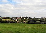
Hungarton
Civil parishes in Harborough DistrictUse British English from July 2015Villages in Leicestershire

Hungarton (or Hungerton) is a small village and civil parish in the Harborough district, in the county of Leicestershire, England, about 10 miles (16 km) north-east of Leicester and 13 miles (21 km) south-west of Melton Mowbray. The population of the civil parish was 269 at the 2001 census, including Ingarsby, and increased to 289 at the 2011 census.
Excerpt from the Wikipedia article Hungarton (License: CC BY-SA 3.0, Authors, Images).Hungarton
Church Lane, Harborough Hungarton
Geographical coordinates (GPS) Address Nearby Places Show on map
Geographical coordinates (GPS)
| Latitude | Longitude |
|---|---|
| N 52.659 ° | E -0.979 ° |
Address
Church Lane
LE7 9JX Harborough, Hungarton
England, United Kingdom
Open on Google Maps


