place

Leyton Cricket Ground

Cricket grounds in EssexCricket grounds in LondonDefunct football venues in EnglandEssex County Cricket ClubSport in Leyton
Sport in the London Borough of Waltham ForestSports venues completed in 1885Use British English from February 2023
LeytonCricketGround
LeytonCricketGround

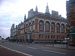
Leyton Cricket Ground (formerly known as the County Ground or the Lyttelton Ground) is a cricket ground in Leyton, London. The ground was the headquarters and main home match venue of Essex County Cricket Club from 1886 until 1933, and was also used by the club for matches between 1957 and 1977. It currently hosts club and community cricket matches and has a listed pavilion.

Excerpt from the Wikipedia article Leyton Cricket Ground (License: CC BY-SA 3.0, Authors, Images).

Leyton Cricket Ground
High Road Leyton, London Leyton (London Borough of Waltham Forest)

Geographical coordinates (GPS) Address Nearby Places
placeShow on map

Wikipedia: Leyton Cricket GroundContinue reading on Wikipedia

Geographical coordinates (GPS)

Latitude Longitude
N 51.567344444444 ° E -0.010783333333333 °
placeShow on map

Address

High Road Leyton
E10 6RT London, Leyton (London Borough of Waltham Forest)
England, United Kingdom
mapOpen on Google Maps

LeytonCricketGround
LeytonCricketGround
Share experience

Nearby Places

Leyton
Leyton

Leyton () is a town in East London, England, within the London Borough of Waltham Forest. It borders Walthamstow to the north, Leytonstone to the east, and Stratford to the south, with Clapton, Hackney Wick and Homerton, across the River Lea, to the west. The area includes New Spitalfields Market, Leyton Orient Football Club, as well as part of the Queen Elizabeth Olympic Park. The town consists largely of terraced houses built between 1870 and 1910, interspersed with some modern housing estates. It is 6.2 miles (10 km) north-east of Charing Cross. It was originally part of the ancient parish of Leyton St Mary in the Becontree hundred and part of historic county of Essex. The town expanded rapidly in the late 19th century, forming part of the conurbation of London and becoming a suburb, similar to much of south-west Essex. It became part of the Metropolitan Police District in 1839 and has been part of the London postal district since its inception in 1856. The parish became an urban district in 1894 and gained municipal borough status in 1926. In 1965, it merged with the neighbouring municipal boroughs of Walthamstow and Chingford to form the London Borough of Waltham Forest, a local government district of Greater London.The town has become one of the most ethnically diverse areas in England, with 69 per cent of residents belonging to a non-British ethnic background. Once a traditional, working class area, it is undergoing large-scale regeneration and gentrification, with large numbers of young professionals moving into the area.