Willesden

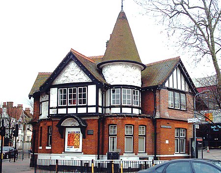
Willesden () is an area of North West London, situated 5 miles (8 km) northwest of Charing Cross. It is historically a parish in the county of Middlesex that was incorporated as the Municipal Borough of Willesden in 1933, and has formed part of the London Borough of Brent in Greater London since 1965. Dollis Hill is also sometimes referred to as being part of Willesden. With its close proximity to affluent neighbourhoods Brondesbury Park, Queen's Park and Kensal Rise, the area surrounding Willesden Green station has seen increased gentrification in the past several years, with rapidly rising property prices. The Daily Telegraph called Willesden Green one of London's "new middle class" areas. The area has a population of 44,295 as of 2011 including the Willesden Green, Dollis Hill and Dudden Hill wards. Willesden Green has one of the city's highest Irish populations, and is also strongly associated with Afro-Caribbeans and Latin Americans.Willesden is mostly in the NW10 postcode district, but part of it is in the NW2 postcode district.
Excerpt from the Wikipedia article Willesden (License: CC BY-SA 3.0, Authors, Images).Willesden
High Road, London Dollis Hill (London Borough of Brent)
Geographical coordinates (GPS) Address Nearby Places Show on map
Geographical coordinates (GPS)
| Latitude | Longitude |
|---|---|
| N 51.5468 ° | E -0.2295 ° |
Address
High Road 99
NW10 2SF London, Dollis Hill (London Borough of Brent)
England, United Kingdom
Open on Google Maps


