place

Stratford, London

Areas of LondonDistricts of the London Borough of NewhamEngvarB from June 2015Major centres of LondonStratford, London
HE1080991 Old Town Hall Stratford (1)

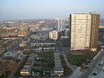
Stratford is a town in east London, England, within the ceremonial county of Greater London. Until 1965 it was within the historic county of Essex. Part of the Lower Lea Valley, Stratford is situated 6 miles (9.7 km) east-northeast of Charing Cross, and includes the localities of Maryland and East Village. Part of the London Borough of Newham, a local government district of Greater London, it was previously part of the parish of West Ham, which historically formed an ancient parish in the hundred of Becontree. Following reform of local government in London in 1965, the parish and borough of West Ham was abolished, becoming part of the borough of Newham in the newly formed Greater London administrative area and ceremonial county. Stratford grew rapidly in the 19th century following the introduction of the railway to the area in 1839, forming part of the conurbation of London, similar to much of south-west Essex. The late 20th century was a period of severe economic decline in the area, eventually reversed by ongoing regeneration associated with the 2012 Summer Olympics, for which Stratford's Queen Elizabeth Olympic Park, part of the large, multi-purpose Stratford City development, was the principal venue. The Westfield Stratford City shopping centre, one of the largest urban shopping centres in Europe, opened in 2011. Stratford is east London's primary retail, cultural and leisure centre, and has also become the second most significant business location in east London after Canary Wharf.

Excerpt from the Wikipedia article Stratford, London (License: CC BY-SA 3.0, Authors, Images).

Stratford, London
Meridian Steps, London Stratford New Town (London Borough of Newham)

Geographical coordinates (GPS) Address Nearby Places
placeShow on map

Wikipedia: Stratford, LondonContinue reading on Wikipedia

Geographical coordinates (GPS)

Latitude Longitude
N 51.5423 ° E -0.00256 °
placeShow on map

Address

Platform 6

Meridian Steps
E15 1DE London, Stratford New Town (London Borough of Newham)
England, United Kingdom
mapOpen on Google Maps

HE1080991 Old Town Hall Stratford (1)
Share experience

Nearby Places

Stratford station
Stratford station

Stratford is a major multi-level railway station which rates as the 5th busiest station in Britain, serving the district of Stratford and the mixed-use development known as Stratford City, in the London Borough of Newham, east London. It is served by the London Underground, London Overground, Docklands Light Railway (DLR) and is also a National Rail station on the West Anglia Main Line and the Great Eastern Main Line, 4 miles 3 chains (6.5 km) from Liverpool Street. It is also the busiest station on the Tube network outside Travelcard Zone 1. On the Underground it is a through-station on the Central line between Mile End and Leyton, and it is the eastern terminus of the Jubilee line following West Ham. On the DLR it is a terminus for some trains and for others it is a through-station between Stratford High Street and Stratford International. On the Overground it is the terminus of the North London Line following Hackney Wick; on the main line it is served by Elizabeth line stopping services between Paddington and Shenfield and by medium- and longer-distance services operated by Greater Anglia to and from numerous destinations in the East of England. There are also limited off-peak services operated by c2c connecting to the London, Tilbury and Southend line to Shoeburyness. The station was opened in 1839 by the Eastern Counties Railway. Today it is owned by Network Rail and is in Travelcard zone 2/3. To distinguish it from Stratford-upon-Avon in Warwickshire it is sometimes referred to as Stratford (London), or as Stratford Regional to differentiate it from Stratford International, which is some 400 yards (370 m) to the north. Stratford served as a key travel hub for the 2012 Olympic and Paralympic Games held in London. By the most recent National Rail entry and exit figures, it is the 5th busiest station in Britain (previously the busiest).

J R Roberts Stores

J R Roberts Stores opened in 1870 in Stratford, London as a drapery and furniture shop at 96 Broadway, before expanding and becoming a full line department store covering 78-102 Broadway. In 1888, it is reported that J R Roberts opened the first Christmas grotto in a UK department store. Later their Christmas fairs were known for animated soldiers, sailors and other toy figures. During the early part of the 20th century, the postcard artist Hermann Fleury Jnr fitted out the Christmas display for a fee of £200.In 1895, Queen Mary Hospital at West Ham opened a new wing and the two main wards were named after J R Roberts who had paid for the furniture.The business expanded in 1899 when they opened a second store in Nelson Street, Southend-on-Sea, as a subsidiary (Company no. 00338672) of the Stratford branch. They also announced they would stop selling alcohol in their Stratford store as part of the temperance movement. In 1933 they moved from Nelson Street to 90 High Street, Southend, which had been home to Percy Ravens since 1900. In 1950 the business was purchased by retail group Hide & Co.In 1954, J R Roberts closed their Stratford store and sold it to the London Co-operative Society (who demolished the old buildings and built a new department store between 1957 and 1962), The Southend store became part of House of Fraser in 1975 after they purchased Hide & Co, and was renamed Chiesmans before becoming Army & Navy. The premises have since been occupied by Dixons / Currys and Morrisons Local.