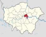
Stepney

Stepney is a district in the East End of London in the London Borough of Tower Hamlets. The district is no longer officially defined, and is usually used to refer to a relatively small area. However, for much of its history the place name applied to a much larger manor and parish. Stepney Green is a remnant of a larger area of Common Land formerly known as Mile End Green.The area was built up rapidly in the 19th century, mainly to accommodate immigrant workers and displaced London poor, and developed a reputation for poverty, overcrowding, violence and political dissent. It was severely damaged during the Blitz, with over a third of housing totally destroyed; and then, in the 1960s, slum clearance and development replaced most residential streets with tower blocks and modern housing estates. Some Georgian architecture and Victorian era terraced housing survive in patches: for example Arbour Square, the eastern side of Stepney Green, and the streets around Matlock Street.
Excerpt from the Wikipedia article Stepney (License: CC BY-SA 3.0, Authors, Images).Stepney
Senrab Street, London Stepney
Geographical coordinates (GPS) Address Nearby Places Show on map
Geographical coordinates (GPS)
| Latitude | Longitude |
|---|---|
| N 51.5152 ° | E -0.0462 ° |
Address
Senrab Street 21
E1 0QW London, Stepney
England, United Kingdom
Open on Google Maps


