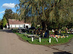
Chinbrook Meadows (sometimes Chinbrook Meadow) is a park in southeast London, England, one of Lewisham's public open spaces. It is located between Chinbrook and Grove Park in the London Borough of Lewisham adjacent to the boundary with the London Borough of Bromley. The park is within the SE12 postcode district, next to the border of the BR1 postcode district.
The majority of the park is maintained short grass with paved footpaths and lined with tall trees and bisected by the River Quaggy which flows northward through the park. The grass often has markings for football pitches, a cricket ground and other sports and is used by local schools for sports days. Chinbrook Meadows contains public toilets, a concrete ball court, a café, a cycle route, a dog exercise area, a football pitch, tennis courts and a children's play area with climbing frames and a sandpit. The numerous footpaths crossing the park form part of The Green Chain Walk and Capital Ring.
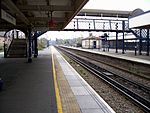
The park is around half a mile long north to south, about half as wide east to west and is surrounded by and has entrances on Chinbrook Road and Amblecote Road to the north, Mayeswood Road to the east, a railway line and Portland Road to the south and west, and Elmstead Wood to the south. Under the railway line there is a pedestrian subway tunnel that crosses the borough boundary into Bromley and links the park to a much smaller green area southwest of the main park. There is no gate separating the two, but the smaller area, being under the authority of another borough the London Borough of Bromley, is sometimes not considered part of the same park, the map on the website does not show it, but shows the park entrance to be the pedestrian subway. The footpath that leaves the southeast corner of Chinbrook Meadows is part of the Green Chain Walk passes some allotments then Grove Park Cemetery before entering Elmstead Wood.
Pedestrian gates to the park remain open throughout the night, whilst the car park gates are opened at 08:00 every morning and closed near dusk, with times ranging from 16:30 to 21:00 in the evening depending on the time of year.


