Kilburn, London

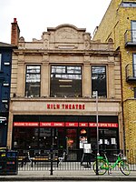
Kilburn is an area of north west London, England, which spans the boundary of three London Boroughs: Camden to the east, City of Westminster, and Brent to the west. There is also an area in the City of Westminster, known as West Kilburn and sometimes treated as a distinct locality. Kilburn High Road railway station lies 3.5 miles (5.6 km) north-west of Charing Cross. Kilburn developed from a linear hamlet that grew up on ancient Watling Street (the modern A5 Road), the hamlet took its name from Kilburn Priory, which was built on the banks of Kilburn Brook. Watling Street forms the contemporary boundary between the boroughs of Brent and Camden. The area has London's highest Irish population, as well as a sizable Afro-Caribbean population. The area is identified in the London Plan as one of 35 major centres in Greater London.
Excerpt from the Wikipedia article Kilburn, London (License: CC BY-SA 3.0, Authors, Images).Kilburn, London
Hartland Road, London Queen's Park (London Borough of Brent)
Geographical coordinates (GPS) Address Nearby Places Show on map
Geographical coordinates (GPS)
| Latitude | Longitude |
|---|---|
| N 51.5366 ° | E -0.2039 ° |
Address
Hartland Road 63
NW6 6BJ London, Queen's Park (London Borough of Brent)
England, United Kingdom
Open on Google Maps


