Heston
Areas of LondonDistricts of the London Borough of HounslowHestonPlaces formerly in MiddlesexUse British English from September 2015

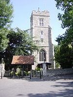
Heston is a suburban area and part of the Hounslow district in the London Borough of Hounslow. The residential settlement covers a slightly smaller area than its predecessor farming village, 10.8 miles (17.4 km) west south-west of Charing Cross and adjoins the M4 motorway but has no junction with it; Heston also adjoins the Great West Road, a dual carriageway, mostly west of the "Golden Mile" headquarters section of it. Heston was, historically, in Middlesex.
Excerpt from the Wikipedia article Heston (License: CC BY-SA 3.0, Authors, Images).Heston
Banksyard, London Heston (London Borough of Hounslow)
Geographical coordinates (GPS) Address Nearby Places Show on map
Geographical coordinates (GPS)
| Latitude | Longitude |
|---|---|
| N 51.4852 ° | E -0.3788 ° |
Address
Banksyard
Banksyard
TW5 0AX London, Heston (London Borough of Hounslow)
England, United Kingdom
Open on Google Maps


