River Colne, Hertfordshire

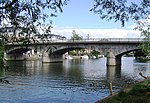
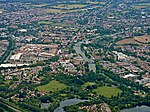
The Colne is a river and a tributary of the River Thames in England. Just over half its course is in south Hertfordshire. Downstream, it forms the boundary between Buckinghamshire and the London Borough of Hillingdon. The confluence with the River Thames is on the Staines reach (above Penton Hook Lock) at Staines-upon-Thames. Two of its distributaries, constructed in the 1600 – 1750 period largely for aesthetic reasons for Hampton Court and for Syon Park, have been maintained. Their main purpose was not drinking water but these can be likened to the New River in scale and in date. Crossing its route, many viaducts and a canal, the intersecting Grand Union Canal, have been recognised for pioneering engineering during the Industrial Revolution. Digging for gravel and clay along its lower course near Rickmansworth has created a belt of flooded pits below the water table, as established lakes, many of which are well-adapted habitats for wildlife, protected as nature reserves. The river, meadows and lakes form the Colne Valley regional park covering 43 square miles (110 km2).
Excerpt from the Wikipedia article River Colne, Hertfordshire (License: CC BY-SA 3.0, Authors, Images).River Colne, Hertfordshire
Colnebridge Close, Borough of Spelthorne
Geographical coordinates (GPS) Address Nearby Places Show on map
Geographical coordinates (GPS)
| Latitude | Longitude |
|---|---|
| N 51.433055555556 ° | E -0.51527777777778 ° |
Address
The River Guardian
Colnebridge Close
TW18 4RZ Borough of Spelthorne
England, United Kingdom
Open on Google Maps


