place

Church Island, River Thames

Borough of SpelthorneIslands of the River ThamesUse British English from June 2017
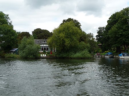
Church Island, Staines (Nancy)

Church Island or Church Eyot is an inhabited island in the River Thames in England on the reach above Penton Hook Lock in Staines-upon-Thames, Spelthorne, Surrey. It is in the upper part of the reach. It is approximately 200 m (660 ft) above Staines Bridge, but is thought by some historians to have been the site of the Roman bridges (Pontes) across the Thames recorded as a waypoint on the Devil's Highway between Londinium (London) and Calleva (Silchester).

Excerpt from the Wikipedia article Church Island, River Thames (License: CC BY-SA 3.0, Authors, Images).

Church Island, River Thames
Church Street, Borough of Spelthorne

Geographical coordinates (GPS) Address Website Nearby Places
placeShow on map

Wikipedia: Church Island, River ThamesContinue reading on Wikipedia

Geographical coordinates (GPS)

Latitude Longitude
N 51.435 ° E -0.52 °
placeShow on map

Address

HK Daybreak

Church Street
TW18 4XH Borough of Spelthorne
England, United Kingdom
mapOpen on Google Maps

Website
hkdaybreak.wordpress.com

linkVisit website

Church Island, Staines (Nancy)
Share experience

Nearby Places

Staines-upon-Thames
Staines-upon-Thames

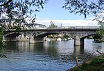
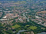
Staines-upon-Thames is a market town in northwest Surrey, England, around 17 miles (28 kilometres) west of central London. It is in the Borough of Spelthorne, at the confluence of the River Thames and Colne. Historically part of Middlesex, the town was transferred to Surrey in 1965. Staines is close to Heathrow Airport and is linked to the national motorway network by the M25 and M3. The earliest evidence of human activity in the area is from the Paleolithic and, during the Neolithic, there was a causewayed enclosure on Staines Moor. The first bridge across the Thames at Staines is thought to have been built by the Romans and there was a settlement in the area around the modern High Street by the end of the 1st century CE. Throughout the Middle Ages, Staines was primarily an agricultural settlement and was held by Westminster Abbey. The first surviving record of a market is from 1218, but one may have taken place near St Mary's Church in the Anglo-Saxon period. The industrialisation of Staines began in the mid-17th century when Thomas Ashby established a brewery in the town. Improvements to the local transport network in the mid-19th century also stimulated an expansion of the local population. The current Staines Bridge, designed by George Rennie, was opened in 1832 by William IV and the first railway line through Staines opened in 1848. The town became a centre for linoleum manufacture in 1864, when Frederick Walton established a factory on the site of the 13th-century Hale Mill. At the end of the 20th century, Staines became infamous as the home town of the fictional film and television character, Ali G. Although many local residents felt that the town's reputation was suffering through its association with the character, Sacha Baron Cohen, the creator of Ali G, praised Staines for being a "lovely, leafy, middle-class suburb... where swans swim under the beautiful bridge". Partly in response to the reaction to the character, Spelthorne Borough Council voted in 2011 to add the suffix "upon-Thames" to the name.