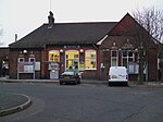
Cheam
District centres of LondonDistricts of the London Borough of SuttonUse British English from August 2015

Cheam () is a suburb of London, England, 10.9 miles (17.5 km) south-west of Charing Cross. It is divided into North Cheam, Cheam Village and South Cheam. Cheam Village contains the listed buildings Lumley Chapel and the 16th-century Whitehall. It is adjacent to two large parks, Nonsuch Park and Cheam Park. Nonsuch Park contains the listed Nonsuch Mansion. Parts of Cheam Park and Cheam Village are in a conservation area. Cheam is bordered by Worcester Park to the north-west, Morden to the north-east, Sutton to the east, Epsom, Ewell and Stoneleigh to the west and Banstead and Belmont to the south.
Excerpt from the Wikipedia article Cheam (License: CC BY-SA 3.0, Authors, Images).Cheam
Revell Road, London Benhilton (London Borough of Sutton)
Geographical coordinates (GPS) Address Nearby Places Show on map
Geographical coordinates (GPS)
| Latitude | Longitude |
|---|---|
| N 51.36 ° | E -0.21 ° |
Address
Revell Road
Revell Road
SM1 2DR London, Benhilton (London Borough of Sutton)
England, United Kingdom
Open on Google Maps


