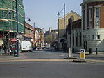
Brixton

Brixton is a district in the south of London, England, within the London Borough of Lambeth. The area is identified in the London Plan as one of 35 major centres in Greater London. Brixton experienced a rapid rise in population during the 19th century as communications with central London improved. Brixton is mainly residential with a prominent street market and substantial retail sector. It is a multiethnic community, with a large percentage of its population of Afro-Caribbean descent. It lies within Inner London and is bordered by Stockwell, Clapham, Streatham, Camberwell, Tulse Hill, Balham and Herne Hill. The district houses the main offices of Lambeth London Borough Council.Brixton is 2.7 miles (4.3 km) south-southeast from the geographical centre of London near Brixton Underground station on the Victoria Line.
Excerpt from the Wikipedia article Brixton (License: CC BY-SA 3.0, Authors, Images).Brixton
Tilia Walk, London Loughborough Junction (London Borough of Lambeth)
Geographical coordinates (GPS) Address Nearby Places Show on map
Geographical coordinates (GPS)
| Latitude | Longitude |
|---|---|
| N 51.463 ° | E -0.106 ° |
Address
Tilia Walk
Tilia Walk
SW9 8RB London, Loughborough Junction (London Borough of Lambeth)
England, United Kingdom
Open on Google Maps


