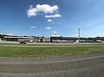
Western Maryland

Western Maryland, also known as the Maryland Panhandle, is the portion of the U.S. state of Maryland that typically consists of Washington, Allegany, and Garrett counties. The region is bounded by Preston County, West Virginia, to the west, the Mason–Dixon line (Pennsylvania) to the north, and the Potomac River and West Virginia to the south. At one point, at the town of Hancock, the northern and southern boundaries are separated by just 1.8 miles, the narrowest stretch in the state. Western Maryland is more rural than the Baltimore-Washington Metropolitan Area, where most of the state's population lives, and is noted for its mountainous terrain. The area is in the central Appalachians. Washington, Allegany, and Garrett counties are part of the Appalachian Regional Commission. The most populous community in Western Maryland is Hagerstown, located in Washington County, the most populous county in the region. Major highways in Western Maryland include Interstate Highways I-70, I-81 and I-68; U.S. Highways U.S. 11, U.S. 40, U.S. 40 ALT, U.S. 219 and U.S. 50; as well as various state highways.
Excerpt from the Wikipedia article Western Maryland (License: CC BY-SA 3.0, Authors, Images).Western Maryland
Hicksville Road,
Geographical coordinates (GPS) Address Nearby Places Show on map
Geographical coordinates (GPS)
| Latitude | Longitude |
|---|---|
| N 39.694508333333 ° | E -77.871094444444 ° |
Address
Hicksville Road
Hicksville Road
Maryland, United States
Open on Google Maps


