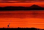
D'Arcy Island
British Columbia Coast geography stubsGreater VictoriaIslands of the Gulf IslandsLeper coloniesUse Canadian English from January 2023

D'Arcy Island is an 83-ha island in Haro Strait, south of Sidney Island and east of the Saanich Peninsula (Vancouver Island). It is the southernmost of the Gulf Islands and is included in its entirety in the Gulf Islands National Park Reserve.
Excerpt from the Wikipedia article D'Arcy Island (License: CC BY-SA 3.0, Authors, Images).D'Arcy Island
North Trail (Unmarked), Southern Gulf Islands Electoral Area
Geographical coordinates (GPS) Address Nearby Places Show on map
Geographical coordinates (GPS)
| Latitude | Longitude |
|---|---|
| N 48.566666666667 ° | E -123.28333333333 ° |
Address
North Trail (Unmarked)
North Trail (Unmarked)
Southern Gulf Islands Electoral Area
British Columbia, Canada
Open on Google Maps


