Portengen
1818 establishments in the NetherlandsAC with 0 elementsFormer municipalities of Utrecht (province)Pages with non-numeric formatnum argumentsPopulated places in Utrecht (province) ... and 2 more
Stichtse VechtUtrecht (province) geography stubs

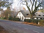
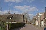
Portengen is a hamlet in the Dutch province of Utrecht. It is located in the municipality of Stichtse Vecht, 1 km (0.62 mi) northeast of Kockengen. Portengen was a separate municipality from 1818 to 1857, when it was merged with Breukelen-Nijenrode.The hamlet was first mentioned in 1217 as Britannien, and is a reference to Brittany, France. It started as a peat excavation colony during the 11th and 12th century. The hamlet of Portengensebrug is an enclave within Portengen. In 1840, Portengen was home to 55 people.
Excerpt from the Wikipedia article Portengen (License: CC BY-SA 3.0, Authors, Images).Portengen
Portengen, Stichtse Vecht
Geographical coordinates (GPS) Address Nearby Places Show on map
Geographical coordinates (GPS)
| Latitude | Longitude |
|---|---|
| N 52.155833333333 ° | E 4.9633333333333 ° |
Address
Portengen 34
3628 EE Stichtse Vecht
Utrecht, Netherlands
Open on Google Maps


