Sproatley
Civil parishes in the East Riding of YorkshireEast Riding of Yorkshire geography stubsHoldernessOpenDomesdayUse British English from June 2015 ... and 1 more
Villages in the East Riding of Yorkshire

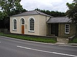
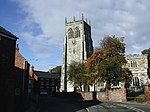
Sproatley is a village and civil parish in the East Riding of Yorkshire, England. It is situated approximately 7 miles (11 km) north-east of Hull city centre and 4 miles (6.4 km) north of Hedon at the junction of the B1238 and B1240 roads. The village church, dedicated to St. Swithin, is said to contain a small chamber organ built by 'Father' Smith in the late 17th, early 18th century. The church was designated a Grade II listed building in 1987. According to the 2011 UK census, Sproatley parish had a population of 1,350, a decrease on the 2001 UK census figure of 1,353.
Excerpt from the Wikipedia article Sproatley (License: CC BY-SA 3.0, Authors, Images).Sproatley
B1238,
Geographical coordinates (GPS) Address Nearby Places Show on map
Geographical coordinates (GPS)
| Latitude | Longitude |
|---|---|
| N 53.79442 ° | E -0.191573 ° |
Address
Constable Arms
B1238
HU11 4PD , Sproatley
England, United Kingdom
Open on Google Maps


