Thirtleby
East Riding of Yorkshire geography stubsFormer civil parishes in the East Riding of YorkshireHoldernessOpenDomesdayUse British English from June 2015 ... and 1 more
Villages in the East Riding of Yorkshire

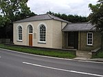
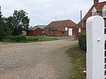
Thirtleby is a hamlet in the civil parish of Coniston, in the East Riding of Yorkshire, England. It is situated approximately 6 miles (9.7 km) north-east of Hull city centre and 1 mile (1.6 km) west of the village of Sproatley. Thirtleby was formerly a township in the parish of Swine, in 1866 Thirtleby became a separate civil parish, on 1 April 1935 the parish was abolished and merged with Coniston. In 1931 the parish had a population of 55.
Excerpt from the Wikipedia article Thirtleby (License: CC BY-SA 3.0, Authors, Images).Thirtleby
Coniston Lane,
Geographical coordinates (GPS) Address Nearby Places Show on map
Geographical coordinates (GPS)
| Latitude | Longitude |
|---|---|
| N 53.7959 ° | E -0.215347 ° |
Address
Thirtleby Grange
Coniston Lane
HU11 4LL , Coniston
England, United Kingdom
Open on Google Maps


