place

Lelley

East Riding of Yorkshire geography stubsFormer civil parishes in the East Riding of YorkshireHoldernessOpenDomesdayUse British English from December 2014
Villages in the East Riding of Yorkshire
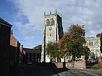
Main Street, Lelley
Main Street, Lelley

Lelley is a small village in the civil parish of Elstronwick, in the East Riding of Yorkshire, England, in an area known as Holderness. It is situated approximately 7 miles (11 km) north-east of Kingston upon Hull city centre and 3 miles (5 km) north of Hedon. Lelley was formerly a township in the parish of Preston, in 1866 Lelley became a civil parish, on 1 April 1935 the parish was abolished and merged with Elstronwick. In 1931 the parish had a population of 112.Lelley comes from the word 'Lelle' which means 'clearing in the woods'.The village contains a public house, two benches (one a war memorial and the other a millennium bench) and a telephone box. Lelley Wesleyan Methodist Church was built in the village in 1859.In 1823 Lelly was in the parish of Preston and the Wapentake and Liberty of Holderness. Population was 119, which included a carrier who operated between the village and Hull once a week.The Lelley Windmill, a six-storey corn mill completed in 1790, is a Grade II* Listed Building.

Excerpt from the Wikipedia article Lelley (License: CC BY-SA 3.0, Authors, Images).

Geographical coordinates (GPS)

Latitude Longitude
N 53.775395 ° E -0.166441 °
placeShow on map

Address


HU12 8SN
England, United Kingdom
mapOpen on Google Maps

Main Street, Lelley
Main Street, Lelley
Share experience

Nearby Places

Elstronwick
Elstronwick

Elstronwick is a village and civil parish in the East Riding of Yorkshire, England, in an area known as Holderness. It is situated approximately 3.5 miles (6 km) north-east of the town of Hedon and 1.5 miles (2.4 km) north-west of the village of Burton Pidsea. The civil parish is formed by the villages of Elstronwick and Lelley together with the hamlet of Danthorpe. According to the 2011 UK census, Elstronwick parish had a population of 298, an increase on the 2001 UK census figure of 287.The parish church of St Lawrence on Front Lane is designated a Grade II listed building and is now recorded in the National Heritage List for England, maintained by Historic England. There is also a chapel. A further Grade II listed building is Elstronwick Hall.Village amenities include a small playing field. In 1823 Baines's History, Directory and Gazetteer of the County of York gave Elstronwick's name as 'Elsternwick'. The village at the time was in the parish of Humbleton and in the Wapentake of Holderness. There was a chapel of ease, "apparently of great antiquity", and a free school. The village had a population of 154, with occupations including six farmers, two wheelwrights, a blacksmith, a shoemaker, and the licensed victualler of The Crown and Anchor public house. Also directory-listed was a school mistress, two gentlemen and a foreman. Once a week a carrier operated between the village and Hull. The Crown and Anchor closed and was converted into cottages c. 2015.

Preston, East Riding of Yorkshire

Preston is a village and civil parish in the East Riding of Yorkshire, England, in an area known as Holderness. It is situated approximately 6 miles (10 km) east of Hull city centre it lies just north of the A1033 road on the crossroads between the B1240 and B1362 roads. The civil parish is formed by the village of Preston and the hamlet of Salt End. According to the 2011 UK census, Preston parish had a population of 3,258, an increase on the 2001 UK census figure of 3,100. The parish church of All Saints is a Grade I listed building.There is both a primary school (Preston Primary School) and a secondary school, which achieved Technology College status in 1997, and has a sixth form facility joined onto the school, in Preston. South Holderness Technology College converted to an academy known as Holderness Academy and serves the surrounding villages of Paull, Hedon, Bilton, Skirlaugh, Keyingham, Thorngumbald, Aldbrough, West Newton, Burton Constable, Sproatley and others. Preston has two pubs, a pizza takeaway, a Chinese takeaway and a garden centre, with a farm shop. There is also a butcher's shop on the main street, along with the Post Office, the Post Office has closed but the shop remains. It also has a hairdressers and a traditional barbers shop. Recently 'Preston (South)' was marked clearly by the Council, however the two are not geographically all that close, and still stand as two separate areas separated in places by Hedon. In February 2023, a £9.6 million crematorium opened off Sproatley Road.