Chesterfield County, Virginia

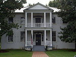
Chesterfield County is located just south of Richmond in the Commonwealth of Virginia. The county's borders are primarily defined by the James River to the north and the Appomattox River to the south. Its county seat is Chesterfield Court House.Chesterfield County was formed in 1749 from parts of Henrico County. It was named for Philip Stanhope, 4th Earl of Chesterfield, a prominent English statesman who had been the Lord Lieutenant of Ireland. As of the 2020 census, the population was 364,548 making it the fourth-most populous county in Virginia (behind Fairfax, Prince William, and Loudoun, respectively). Chesterfield County is part of the Greater Richmond Region, and the county refers to much of the northern portion of the county as "North Chesterfield".
Excerpt from the Wikipedia article Chesterfield County, Virginia (License: CC BY-SA 3.0, Authors, Images).Chesterfield County, Virginia
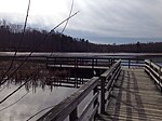
Beaver Lake Trail,
Geographical coordinates (GPS) Address Nearby Places Show on map
Geographical coordinates (GPS)
| Latitude | Longitude |
|---|---|
| N 37.38 ° | E -77.59 ° |
Address
Beaver Lake Trail
Beaver Lake Trail
23832
Virginia, United States
Open on Google Maps


