Lower Peover
Cheshire geography stubsCivil parishes in CheshireVillages in Cheshire

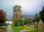
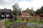
Lower Peover is a village in the civil parish of Nether Peover in the unitary authority of Cheshire West and Chester and the ceremonial county of Cheshire, England, approximately 6 miles east of Northwich and 4 miles south of Knutsford. The boundary of the civil parish deviates slightly to include Lower Peover in Nether Peover and not the adjacent civil parish of Peover Inferior. The population of the civil parish at the 2011 census was 415.Lower Peover was also where George S. Patton held meetings with the senior members of the British war cabinet where they discussed plans about many military operations, most notably D-day.
Excerpt from the Wikipedia article Lower Peover (License: CC BY-SA 3.0, Authors, Images).Lower Peover
Free Green Lane,
Geographical coordinates (GPS) Address Nearby Places Show on map
Geographical coordinates (GPS)
| Latitude | Longitude |
|---|---|
| N 53.266 ° | E -2.383 ° |
Address
Free Green Lane
Free Green Lane
WA16 9QU , Peover Inferior
England, United Kingdom
Open on Google Maps


