Cézembre

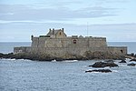
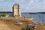
Cézembre is an island in Brittany, in the Ille-et-Vilaine département of France, near Saint-Malo. The island is uninhabited, with a surface area of approximately 18 hectares (44 acres), a length of 750 metres (2,461 ft), and a maximum width of 250 metres (820 ft). The island features a fine sandy beach facing Saint-Malo on the south, and a steep and rocky coast around the rest of the island. As elsewhere in northern Brittany, the tidal range is among the highest in the world. Until the seventeenth century, the island could be reached on foot at low tide from Saint Malo. The island's beach is popular in summer with visitors arriving by yacht or motorboat and there are also regular shuttles from St-Malo, although landing is only possible at high tide. A small restaurant serves lunches and prebooking is essential. Cézembre was inhabited by a number of hermits over the centuries, and featured a monastery for a time. There were also five small chapels. The chapel dedicated to Saint Brendan was built in 1420 by a hermit priest from Saint-Malo, Raoul Boisserel. Vauban fortified the island at the end of the seventeenth century, and it was used thereafter as a place of quarantine, with cargo stored in Saint Brendan's chapel. During World War I, the Belgian Army installed a disciplinary company on Cézembre. Prior to its destruction during World War II, Saint Brendan's Oratory was a place of pilgrimage for unmarried women who would prick the nose of a wooden statue of the saint with a pin in the hope of a good marriage.
Excerpt from the Wikipedia article Cézembre (License: CC BY-SA 3.0, Authors, Images).Cézembre
Avenue du Château Hébert, Saint-Malo
Geographical coordinates (GPS) Address Website Nearby Places Show on map
Geographical coordinates (GPS)
| Latitude | Longitude |
|---|---|
| N 48.676666666667 ° | E -2.0713888888889 ° |
Address
Le Repaire des Corsaires
Avenue du Château Hébert
35800 Saint-Malo, Saint-Énogat
Brittany, France
Open on Google Maps


