Rance (river)
Brittany geography stubsCoastal basins of the English Channel in FranceFrance river stubsPages including recorded pronunciationsPages with Breton IPA ... and 5 more
Pages with French IPARivers of BrittanyRivers of Côtes-d'ArmorRivers of FranceRivers of Ille-et-Vilaine

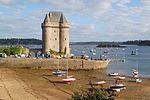
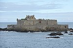
The Rance (French pronunciation: [ʁɑ̃s] ; Breton: Renk, [ˈrẽŋk]) is a river of northwestern France. It is 103.6 km (64.4 mi) long. It flows into the English Channel between Dinard and Saint-Malo. Before reaching the Channel, its waters are barred by a 750 metre long dam forming the Rance tidal power plant. The river is linked to the Vilaine by means of the Canal d'Ille-et-Rance. Départements and towns along the river: Côtes-d'Armor: Collinée, Caulnes, Dinan Ille-et-Vilaine: Dinard, Saint-Malo
Excerpt from the Wikipedia article Rance (river) (License: CC BY-SA 3.0, Authors, Images).Rance (river)
Saint-Malo
Geographical coordinates (GPS) Address Nearby Places Show on map
Geographical coordinates (GPS)
| Latitude | Longitude |
|---|---|
| N 48.641111111111 ° | E -2.0405555555556 ° |
Address
Alet
35400 Saint-Malo, Saint-Servan - Solidor
Brittany, France
Open on Google Maps


