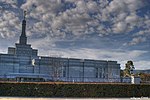
Vale Park, South Australia
Adelaide geography stubsSuburbs of AdelaideUse Australian English from August 2019
Vale Park is a suburb of Adelaide in the Town of Walkerville, Australia. It is located northeast of the Adelaide city centre between North East Road and the River Torrens, astride Ascot Avenue, part of the A17 highway which is the eastern ring route bypass of Adelaide. Vale Park was originally a private subdivision named after Vale House, the home of Philip Levi, a pastoral pioneer.
Excerpt from the Wikipedia article Vale Park, South Australia (License: CC BY-SA 3.0, Authors).Vale Park, South Australia
Angas Avenue, Adelaide Vale Park
Geographical coordinates (GPS) Address Nearby Places Show on map
Geographical coordinates (GPS)
| Latitude | Longitude |
|---|---|
| N -34.8875252 ° | E 138.6244612 ° |
Address
Angas Avenue
Angas Avenue
5081 Adelaide, Vale Park
South Australia, Australia
Open on Google Maps


