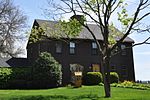
Providence River

The Providence River is a tidal river in the U.S. state of Rhode Island. It flows approximately 8 miles (13 km). There are no dams along the river's length, although the Fox Point Hurricane Barrier is located south of downtown to protect the city of Providence from damaging tidal floods. The southern part of the river has been dredged at a cost of $65 million in federal and state funds to benefit nearby marinas and commercial shipping interests. The Dutch called the Providence River the Nassau River. It was the northeastern limit of Dutch claims in the colonial era, owing to Adriaen Block's exploration of Narragansett Bay, from 1614 until the Hartford Treaty of 1650. It can, therefore, be regarded as the original boundary between the English New England colonies and the Dutch colony of New Netherland.
Excerpt from the Wikipedia article Providence River (License: CC BY-SA 3.0, Authors, Images).Providence River
Nayatt Point Court,
Geographical coordinates (GPS) Address Nearby Places Show on map
Geographical coordinates (GPS)
| Latitude | Longitude |
|---|---|
| N 41.721 ° | E -71.348 ° |
Address
Nayatt Point Court
02806
Rhode Island, United States
Open on Google Maps


