place

Trossachs

All accuracy disputesGeography of Stirling (council area)Highlands and Islands of ScotlandNational nature reserves in ScotlandNational scenic areas of Scotland
Protected areas of Stirling (council area)Trossachs
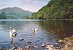
Wooded area of the Trossachs and Loch Katrine

The Trossachs (; Scottish Gaelic: Na Tròiseachan) generally refers to an area of wooded glens, braes, and lochs lying to the east of Ben Lomond in the Stirling council area of Scotland. The name is taken from that of a small woodland glen that lies at the centre of the area, but is now generally applied to the wider region. The wooded hills and lochs of the area may be considered to represent a microcosm of a typical highland landscape, and the woodlands are an important habitat for many species. Much of the Trossachs area is protected by various different conservation designations, including the Great Trossachs Forest National Nature Reserve.The Trossachs form part of the Loch Lomond and The Trossachs National Park, which was established in 2002. The area has long been visited by tourists due to the relative proximity of major population centres such as Glasgow and Stirling, and remains popular with walkers, cyclists and tourists. Scenic boat rides on Loch Katrine are popular with visitors: the steamer SS Sir Walter Scott, launched in 1899, remains in operation. The Great Trossachs Path, one of Scotland's Great Trails, is a 48 km route suitable for walkers, cyclists and horse riders. It runs between Callander in the east and Inversnaid on the banks of Loch Lomond in the west, passing along the northern shores of Loch Katrine and Loch Arklet.

Excerpt from the Wikipedia article Trossachs (License: CC BY-SA 3.0, Authors, Images).

Geographical coordinates (GPS)

Latitude Longitude
N 56.231 ° E -4.425 °
placeShow on map

Address

A821
FK17 8HZ
Scotland, United Kingdom
mapOpen on Google Maps

Wooded area of the Trossachs and Loch Katrine
Share experience

Nearby Places

Ben Venue
Ben Venue

Ben Venue (Scottish Gaelic: A' Bheinn Mheanbh) is a mountain in the Trossachs area of Scotland. The name Ben Venue is derived from the Scottish Gaelic words meaning "the miniature mountain". The summit lies approximately 2 kilometres south-west of the pier at the southern end of Loch Katrine. At the foot of the mountain close to the shore of Loch Katrine is Bealach nam Bò meaning the "pass of the cattle", a reference to the lawless days when Highland cattle "lifters" used the pass to drive stolen herds to their land. Ben Venue is a popular walk and can be accessed from either Ledard farm track at Loch Ard, via the Beinn an Fhogharaidh ridge, or from the car park at the head of Loch Achray: both routes are approximately 5 km in length. A sign in the forestry warns that the mountain should not be approached or descended directly to or from Loch Katrine, as the slopes on this side are very steep and littered with dangerous cliffs. Several indistinct paths do exist on this side of the hill however. Ben Venue has two summits a short distance apart. The triangulation pillar on the eastern summit has a height of 727 m above sea level, and this height is often given as the height of Ben Venue as a whole. However the western summit is shown to be slightly higher, 729 m, on the Ordnance Survey's 1:25000 map. From (either) summit on a clear day the view extend to the Firth of Forth, the Clyde and Isle of Arran and the Paps of Jura. Good views can be seen along Loch Katrine, Ben A'an, Ben More, Stob Binnein, Ben Lomond and the Arrochar Alps.