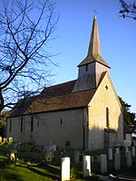
Oving, West Sussex
Chichester DistrictVillages in West Sussex

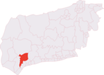
Oving is a small village, and civil and ecclesiastical parish in the Chichester District of West Sussex, England. The village lies about 2.5 miles (4.0 km) east of the city of Chichester. The civil parish includes the settlements of Colworth, Drayton, Merston, and Shopwhyke.
Excerpt from the Wikipedia article Oving, West Sussex (License: CC BY-SA 3.0, Authors, Images).Oving, West Sussex
Church Lane, Chichester Oving
Geographical coordinates (GPS) Address Nearby Places Show on map
Geographical coordinates (GPS)
| Latitude | Longitude |
|---|---|
| N 50.83719 ° | E -0.72093 ° |
Address
Church Lane
Church Lane
PO20 2DG Chichester, Oving
England, United Kingdom
Open on Google Maps


