place

Fort Delaware State Park

1951 establishments in DelawareHistory museums in DelawareLiving museums in the United StatesMilitary and war museums in DelawareMuseums in New Castle County, Delaware
Open-air museums in the United StatesParks in New Castle County, DelawareProtected areas established in 1951State parks of Delaware
Fort Delaware LOC 384066pu

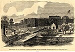
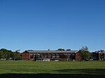
Fort Delaware State Park is a 288-acre (117 ha) Delaware state park on Pea Patch Island in New Castle County, Delaware. A fortress was built on Pea Patch Island by the United States Army in 1815, near the conclusion of the War of 1812, to protect the harbors of Wilmington, Delaware and Philadelphia, Pennsylvania. The fort was burned and rebuilt in the years prior to the American Civil War, and soon after the start of the war the fort was converted to a Prisoner of War camp. Fort Delaware continued to protect the mouth of the Delaware River through World War I and II. Pea Patch Island and Fort Delaware was declared surplus land by the United States Department of Defense in 1945. Fort Delaware State Park, one of the first state parks in Delaware, was established in 1951. The park, which can only be accessed by ferry, is open for historic programs at Fort Delaware. The fort is listed on the National Register of Historic Places. In addition to historical preservation, Fort Delaware State Park is also open for picnicking and hiking. Visitors to the park may reach it by ferry from Delaware City or Fort Mott State Park in New Jersey. Fort Delaware State Park is 0.5-mile (800 m) from Delaware City via the Forts Ferry Crossing. Passengers aboard the ferry are granted access to Fort Mott State Park.

Excerpt from the Wikipedia article Fort Delaware State Park (License: CC BY-SA 3.0, Authors, Images).

Fort Delaware State Park
Clinton Street,

Geographical coordinates (GPS) Address Nearby Places
placeShow on map

Wikipedia: Fort Delaware State ParkContinue reading on Wikipedia

Geographical coordinates (GPS)

Latitude Longitude
N 39.593055555556 ° E -75.572222222222 °
placeShow on map

Address

Fort Delaware

Clinton Street
19706
Delaware, United States
mapOpen on Google Maps

Fort Delaware LOC 384066pu
Share experience

Nearby Places

Pea Patch Island
Pea Patch Island

Pea Patch Island is a small island, approximately 1 mi (1.6 km) long, in the U.S. state of Delaware, located in the mid channel of the Delaware River near its entrance into Delaware Bay. It is a low, marshy island, located in New Castle County, facing Delaware City on the Delaware shore, and Finns Point on the New Jersey shore. Once the location of strategic military defenses, the island is currently owned by the State of Delaware as Fort Delaware State Park. The island emerged as a mud bank in the river in the 18th century. According to folklore, the island received its name after a ship full of peas ran aground on it, spilling its contents and leading to a growth of the plant on the island. In the 1790s, Pierre L'Enfant suggested the use of the island as part of the defenses of New Castle, Delaware and Philadelphia. During the War of 1812, a seawall and dykes were built on the island, with a view to building a Martello tower there. By 1814, the island had been sufficiently developed for the construction of the first Fort Delaware. A five-pointed star fort was built 1815–1824. However, this fort was wrecked by a fire in 1831. Construction began on a much larger polygonal fort in 1836, but this project was derailed by a decade-long legal battle over which state owned the island, which was won by Delaware. Construction then began in 1848 on the current fort, with an irregular pentagon design about the size of the previous star fort. The fort was substantially complete by 1860. During the American Civil War, Fort Delaware was used by the Union as a camp for Confederate prisoners, in particular ones captured at the 1863 Battle of Gettysburg. Many of the prisoners and some guards who died at the fort are buried at nearby Finns Point National Cemetery in New Jersey. Around the turn of the century, a large battery for three then-modern 12-inch guns on disappearing carriages was built in the fort as part of the Endicott program, with batteries for smaller guns elsewhere on the island. On the shores flanking the island, Fort DuPont and Fort Mott were built with modern weapons, and preparations were made to lay underwater minefields in the river. The defenses around Pea Patch Island were disarmed during World War II, as Fort Miles at the mouth of the Delaware estuary superseded them. In the early 20th century, the U.S. Army Corps of Engineers dredged a channel around the island, using the infill to double the island's size on its northern end. The island is publicly accessible by ferry from both the Delaware and New Jersey banks. In addition to the historic features of the state park, the island provides a significant wetlands stop for migratory birds along the Atlantic Flyway. It is the location of the largest colony of herons in the U.S. north of Florida.

Fort DuPont
Fort DuPont

Fort DuPont, named in honor of Rear Admiral Samuel Francis Du Pont, is located between the original Delaware City and the modern Chesapeake and Delaware Canal on the original Reeden Point tract, which was granted to Henry Ward in 1675. Along with two other forts of the Harbor Defenses of the Delaware, it defended the Delaware River and the water approach to Philadelphia from 1900 through 1942. In 2016, the acreage which is not in the state park system was annexed into Delaware City. The first fortification built was the Ten Gun Battery, an auxiliary to nearby Fort Delaware during the American Civil War. The Twenty Gun Battery was constructed on the reservation during the 1870s, later followed by a mine control casemate for an underwater minefield in 1876. In 1897-1904, Endicott-era emplacements were constructed for long-range rifles, mortars, and rapid-fire guns. In 1922 the post became headquarters for the 1st Engineer Regiment, which remained at the post until 1941. During World War II, Fort DuPont served as a mobilization station for deploying units, and contained a prisoner-of-war camp for captured German soldiers and sailors. After the war, Fort DuPont was declared surplus and offered to the Veterans Administration for use as a veterans hospital. After they declined, the state bought the site at a 100 percent discount and adapted existing structures for reuse. In 1948, it officially opened as the Governor Walter W. Bacon Health Center. In 1992 a portion was redesignated as Fort DuPont State Park, which became Delaware's 13th state park. In 1999 the site was officially designated the Fort DuPont Historic District after it was listed in the National Register of Historic Places. The historic district comprises Fort DuPont State Park and the Governor Bacon Health Center. The site is currently being redeveloped by the Fort DuPont Redevelopment and Preservation Corporation.