place

Norwich Airport

1940 establishments in EnglandAC with 0 elementsAirports established in 1940Airports in EnglandAirports in Norfolk
NorwichTransport in NorwichUse British English from May 2013
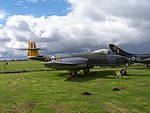
Norwich Airport geograph.org.uk 22532

Norwich Airport (IATA: NWI, ICAO: EGSH) is a small international airport in Hellesdon, Norfolk, England, 2.5 miles (4.0 km) north of Norwich. In 2017, Norwich Airport was the 28th busiest airport in the UK and busiest in the East Anglia region.Norwich Airport has a CAA Public Use Aerodrome Licence that allows flights for the public transport of passengers or for flying instruction. Along with a long history of flights to Amsterdam Airport Schiphol via KLM Cityhopper, it offers flights to various destinations in the United Kingdom and Europe. Besides the commercial flights, charter operators also operate out of Norwich. Bristow Helicopters, DanCopter and Babcock Mission Critical Services Offshore fly crews to North Sea gas rigs and SaxonAir operates executive, private aircraft and helicopter charter flights. The airport was established on the site of a former RAF base in the early 1970s under the ownership of the local authorities. It was later sold into private ownership.

Excerpt from the Wikipedia article Norwich Airport (License: CC BY-SA 3.0, Authors, Images).

Norwich Airport
Bullock Hill, Broadland Horsham St. Faith and Newton St. Faith

Geographical coordinates (GPS) Address Website External links Nearby Places
placeShow on map

Wikipedia: Norwich AirportContinue reading on Wikipedia

Geographical coordinates (GPS)

Latitude Longitude
N 52.675833333333 ° E 1.2827777777778 °
placeShow on map

Address

Norwich Airport

Bullock Hill
NR10 3HT Broadland, Horsham St. Faith and Newton St. Faith
England, United Kingdom
mapOpen on Google Maps

Website
norwichairport.co.uk

linkVisit website

linkWikiData (Q349673)
linkOpenStreetMap (535525)

Norwich Airport geograph.org.uk 22532
Share experience

Nearby Places

Horsham St Faith
Horsham St Faith

Horsham St Faith is a village in Norfolk, England. The village lies close and to the east of the A140 road and is 5 miles (8.0 km) north of Norwich and some 8 miles (12.9 km) south of Aylsham It takes its name from the River Hor, which runs through it on its way from Horsford to Horstead; and a Benedictine priory, founded in honour of St Faith that, until the dissolution of the monasteries, stood there. It is near Norwich International Airport, which began in 1939 as RAF Horsham St Faith and home of the City of Norwich Aviation Museum. Administratively it is in the civil parish of Horsham St Faith and Newton St Faith within the district of Broadland. It also forms part the wider Norwich Built-up area. The name 'Horsham' means 'horse homestead/village'. It has the remains of a Horsford Castle, a motte and bailey castle, on the Horsford side of the A140 road, reached by following a track to the north of Church Street, which joins Horsford and Horsham St Faith. On 17 October from the early 12th century until 1872 it played host to one of the country's largest cattle fairs. This fair was held to the south of Spixworth Road around Bullock Hill and Calf Lane.At the beginning of the 20th century, the Manor House and the land that in 1939 became RAF Horsham St Faith, was owned by John Thomas Spurrell, youngest son of Richard James Spurrell, of Thurgarton. Inside the church at Horsham St Faith there is a memorial to his eldest son, John Francis Brabazon Spurrell, who was killed by buffalo at Kibaya, Tanganyika, in 1927.

Firside Junior School