place

Brooklyn Heights

1646 establishments in the Dutch EmpireBrooklyn HeightsNeighborhoods in Brooklyn
Brooklyn Heights Townhouses

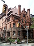
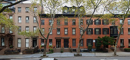
Brooklyn Heights is a residential neighborhood within the New York City borough of Brooklyn. The neighborhood is bounded by Old Fulton Street near the Brooklyn Bridge on the north, Cadman Plaza West on the east, Atlantic Avenue on the south, and the Brooklyn–Queens Expressway or the East River on the west. Adjacent neighborhoods are Dumbo to the north, Downtown Brooklyn to the east, and Cobble Hill and Boerum Hill to the south. Originally referred to as Brooklyn Village, it has been a prominent area of Brooklyn since 1834. The neighborhood is noted for its low-rise architecture and its many brownstone rowhouses, most of them built prior to the Civil War. It also has an abundance of notable churches and other religious institutions. Brooklyn's first art gallery, the Brooklyn Arts Gallery, was opened in Brooklyn Heights in 1958. In 1965, a large part of Brooklyn Heights was protected from unchecked development by the creation of the Brooklyn Heights Historic District, the first such district in New York City. The district was added to the National Register of Historic Places in 1966. Directly across the East River from Manhattan and connected to it by subways and regular ferry service, Brooklyn Heights is also easily accessible from Downtown Brooklyn. Columbia Heights, an upscale six-block-long street next to the Brooklyn Heights Promenade, is sometimes considered to be its own neighborhood. Brooklyn Heights is part of Brooklyn Community District 2, and its primary ZIP Code is 11201. It is patrolled by the 84th Precinct of the New York City Police Department. The New York City Fire Department operates two fire stations near Brooklyn Heights: Engine Company 205/Ladder Company 118 at 74 Middagh Street, and Engine Company 224 at 274 Hicks Street.

Excerpt from the Wikipedia article Brooklyn Heights (License: CC BY-SA 3.0, Authors, Images).

Brooklyn Heights
Pierrepont Street, New York Brooklyn

Geographical coordinates (GPS) Address Nearby Places
placeShow on map

Wikipedia: Brooklyn HeightsContinue reading on Wikipedia

Geographical coordinates (GPS)

Latitude Longitude
N 40.696 ° E -73.995 °
placeShow on map

Address

Pierrepont Street 55
11201 New York, Brooklyn
New York, United States
mapOpen on Google Maps

Brooklyn Heights Townhouses
Share experience

Nearby Places

Brooklyn Heights Historic District

The Brooklyn Heights Historic District is a historic district that comprises much of the Brooklyn Heights neighborhood of Brooklyn, New York City. It was named a National Historic Landmark in January, 1965, designated a New York City Landmark in November, 1965, and added to the National Register of Historic Places in October, 1966.The district is bounded by Cadman Plaza West (Old Fulton Street) on the north, the Brooklyn-Queens Expressway on the west, Atlantic Avenue on the south, and an irregular line that partly follows Clinton and Henry Streets on the east. It is of national significance as an early commuter suburb, and as a remarkably well-preserved 19th-century urban streetscape.Grace Episcopal Church, designed by Richard Upjohn, which held its first service in 1848, is in the district, as are Plymouth Church of the Pilgrims, Our Lady of Lebanon Maronite Cathedral, the First Presbyterian Church, the First Unitarian Congregational Society, the Center for Brooklyn History, the Heights Casino and Casino Apartments, Packer Collegiate Institute, and St. Ann's and the Holy Trinity Church, among other historically notable buildings.The development of Brooklyn Heights as a fashionable residential area began with the introduction of ferry service to Manhattan in 1814. By the mid-19th century, the area was served by three ferry services as well as the Brooklyn and Jamaica Railroad, and it was one of New York's premier residential addresses. The latter distinction was eventually eclipsed by Fifth Avenue. Some of its streets are named for early real estate developers.

New York State Supreme Court, Appellate Division, Second Department

The Supreme Court of the State of New York, Appellate Division, Second Judicial Department, or simply the Second Department, is one of the four geographical components of the Supreme Court, Appellate Division, the intermediate appellate court of the State of New York. Its courthouse is located in Brooklyn, New York City. The court has jurisdiction to hear civil and criminal appeals from the trial courts located in 10 counties: Dutchess, Orange, Putnam, Rockland, and Westchester in the Hudson Valley, Nassau and Suffolk on Long Island, and Kings (Brooklyn), Queens, and Richmond (Staten Island) in New York City. These counties comprise 8% of New York State's land area, yet account for more than 50% of its population.As with all four departments of the Appellate Division, the Second Department was created in its current form by the Constitution of the State of New York, adopted at the 1894 constitutional convention. The constitution fixes the number of justices at seven, but the governor may designate additional justices if there is a need. The court currently has 22 judicial seats.As of 2021, the Second Department is the busiest appellate court in the United States and decides 65% of all cases in the Appellate Division. The court issued more than 3,500 rulings in 2017. Its caseload first surpassed that of the First Department, based in Manhattan, in 1966.The Second Department courthouse was designed by Slee & Bryson in the neoclassical style. Construction began on March 1, 1937, and the courthouse opened on September 28, 1938.