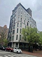
Kips Bay, Manhattan
Former baysKips Bay, ManhattanNeighborhoods in ManhattanUse mdy dates from June 2022

Kips Bay, or Kip's Bay, is a neighborhood on the east side of the New York City borough of Manhattan. It is roughly bounded by East 34th Street to the north, the East River to the east, East 27th and/or 23rd Streets to the south, and Third Avenue to the west.Kips Bay is part of Manhattan Community District 6, and its primary ZIP Codes are 10010 and 10016. It is patrolled by the 13th and 17th Precincts of the New York City Police Department.
Excerpt from the Wikipedia article Kips Bay, Manhattan (License: CC BY-SA 3.0, Authors, Images).Kips Bay, Manhattan
East 29th Street, New York Manhattan
Geographical coordinates (GPS) Address Nearby Places Show on map
Geographical coordinates (GPS)
| Latitude | Longitude |
|---|---|
| N 40.741666666667 ° | E -73.978055555556 ° |
Address
East 29th Street & 2nd Avenue
East 29th Street
10016 New York, Manhattan
New York, United States
Open on Google Maps


