Forrestfield, Western Australia
Forrestfield, Western AustraliaSuburbs in the City of KalamundaSuburbs of Perth, Western AustraliaUse Australian English from March 2014

Forrestfield is a suburb of the City of Kalamunda in Western Australia. It lies 15 kilometres to the south-east of Perth at the base of the Darling Scarp and the southern border of Perth Airport. The suburb is split by Roe Highway into a southern residential area and a northern industrial area. The suburb is adjacent to Wattle Grove, Cloverdale and Kalamunda.
Excerpt from the Wikipedia article Forrestfield, Western Australia (License: CC BY-SA 3.0, Authors, Images).Forrestfield, Western Australia
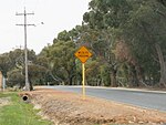
Roe Highway PSP, City Of Kalamunda
Geographical coordinates (GPS) Address Nearby Places Show on map
Geographical coordinates (GPS)
| Latitude | Longitude |
|---|---|
| N -31.98 ° | E 115.993611 ° |
Address
Roe Highway PSP
Roe Highway PSP
6058 City Of Kalamunda, Forrestfield
Western Australia, Australia
Open on Google Maps


