place

Annisquam River

Bodies of water of Essex County, MassachusettsEstuaries of MassachusettsGloucester, MassachusettsUse mdy dates from May 2012
Annisquam River (Massachusetts) map

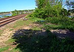
The Annisquam River is a tidal, salt-water estuary in the Annisquam neighborhood of Gloucester, Massachusetts, connecting Annisquam Harbor on the north to Gloucester Harbor on the south. The segment between Gloucester Harbor and the Newburyport/Rockport Line bridge is also known as the Blynman Canal. The estuary is about 4.5 miles (7.2 km) long, navigable, and open to the ocean at both ends. Its surface area is 1.9 square miles (4.9 km2). The name "Annisquam" comes from an Algonquian term meaning "top of the rock, containing , "on top of", and <-ompsk>, "rock". The first European settlement in Annisquam was established in 1631. The river was dredged by the United States Army Corps of Engineers in 1965 to create a channel some 8 feet (2.4 m) deep, and 60 to 200 feet (18 to 61 m) wide. Annisquam Harbor Light stands on the east, Cape Ann, side of the north entrance to the river. There are only three fixed crossings of the river: Massachusetts Route 128, the Rockport Branch of the MBTA Newburyport/Rockport Line, and Western Avenue (Massachusetts Route 127). There are strong tidal currents in the river, and unusually the current flows in opposite directions at the two ends.

Excerpt from the Wikipedia article Annisquam River (License: CC BY-SA 3.0, Authors, Images).

Annisquam River
Quincy Court, Gloucester

Geographical coordinates (GPS) Address Nearby Places
placeShow on map

Wikipedia: Annisquam RiverContinue reading on Wikipedia

Geographical coordinates (GPS)

Latitude Longitude
N 42.655 ° E -70.685555555556 °
placeShow on map

Address

Quincy Court 9
09130 Gloucester
Massachusetts, United States
mapOpen on Google Maps

Annisquam River (Massachusetts) map
Share experience

Nearby Places

Norwood-Hyatt House
Norwood-Hyatt House

The Norwood-Hyatt House is a historic house at 704 Washington Street in the Gloucester, Massachusetts. It is notable as one of the oldest houses in Gloucester, and for its association with Alpheus Hyatt, who did research in marine biology here before establishing the Marine Biological Laboratory at Woods Hole. The oldest part of the house is estimated to have been built in 1664 for Francis Norwood, a mariner and early settler of Gloucester. It remained in the hands of Norwood family descendants until 1879, when Cape Ann Bank took the house by foreclosure. It was acquired that year by Audella Hyatt, wife of Alpheus Hyatt. In 1880 Hyatt used the property as a base for marine research, but abandoned that use, finding it unsuitable, after one season. It was owned by descendants of the Hyatts until 1987.The construction history of the house has not been researched in detail. It is a 2.5-story wood-frame structure, with its earliest framing members showing evidence of 17th century construction methods. It was repeatedly expanded, particularly during the Norwood family's ownership, to reach its present configuration. The main block of the house is five window bays wide, and there is a two-story ell added on to the west side (probably in the early 19th century), and several shed-style additions on the northwest part of the house. The foundation is mainly mortared stone, but the eastern wall is made of brick.The interior of the house has significant features that remain from the 17th and 18th centuries. Many original fireplaces and mantels survive, although most of the fireplaces have been covered over. There are wide pine floors, and the walls and woodwork show many examples of 18th and 19th century construction techniques. Many of the walls were painted with artwork, largely by Audella Hyatt.The house was listed on the National Register of Historic Places in 2000.