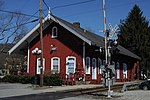
Kent, Connecticut
Kent, ConnecticutSchaghticoke tribeTowns in ConnecticutTowns in Litchfield County, ConnecticutTowns in Northwest Hills Planning Region, Connecticut ... and 2 more
Towns in the New York metropolitan areaUse mdy dates from July 2023

Kent is a town in Litchfield County, Connecticut, United States. Located alongside the border with New York, the town's population was 3,019 according to the 2020 census. The town is part of the Northwest Hills Planning Region. Kent is home to three boarding schools: Kent School, the Marvelwood School, and South Kent School. The Schaghticoke Indian Reservation is also located within town borders. The town was also home to former U.S. Secretary of State Henry Kissinger.
Excerpt from the Wikipedia article Kent, Connecticut (License: CC BY-SA 3.0, Authors, Images).Kent, Connecticut
Segar Mountain Road,
Geographical coordinates (GPS) Address Nearby Places Show on map
Geographical coordinates (GPS)
| Latitude | Longitude |
|---|---|
| N 41.731666666667 ° | E -73.4525 ° |
Address
Cobble Brook Vista Preserve
Segar Mountain Road
06785
Connecticut, United States
Open on Google Maps


