place

Anstey Castle

Castles in HertfordshireUse British English from March 2020
Anstey Castle (geograph 2386536)

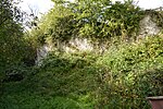
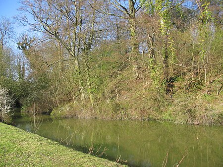
Anstey Castle was in the village of Anstey, Hertfordshire. It was a 12th-century stone motte and bailey fortress that, according to tradition, was founded by Eustace II, Count of Boulogne. It was either him, or one of his immediate progeny who established the first earthwork castle here. The castle had most probably been in existence for some time when the estate was acquired by Geoffrey de Mandeville, for he sought to strengthen his estate in the surrounding valley. It passed into the hands of the de Anstey family in the middle of the 12th century and was strengthened during the First Barons' War of 1215–1216 by Nicholas de Anstey, an opponent of King John, fighting for the barons. After the war ended de Anstey was commanded in 1218 to destroy the castle, with only those parts to remain that had been built before the war. The material from this demolition was supposed to be used in order to repair the nearby church, therefore the crest and shield from the castle feature in the church graffiti.After the death of de Anstey in 1225, the castle and the surrounding estate was seized by the king from his daughter who was a minor at that time. He tasked William Fitz Baldwin to acquire the estate and deliver it to Robert de Rokele, who shall keep it on behalf of the Bishop of Canterbury. the castle is mentioned as such in 1304, but by 1314, it is mentioned as merely a manor, not as a castle.Today, the remains of the castle include a large motte around 8.2 metres (27 ft) in height and measuring 75 by 65 metres (246 by 213 ft). A 10-metre (33 ft) ditch filled with water surrounds the motte, while the bailey to the north and the east is surrounded by a dry ditch. A large mound also remains on the site, which was excavated in 1902–1903 by R.T. Andrews and W. B Gerish but their findings about the age of the castle and when it was built were inconclusive.

Excerpt from the Wikipedia article Anstey Castle (License: CC BY-SA 3.0, Authors, Images).

Anstey Castle
St Georges End, East Hertfordshire Anstey

Geographical coordinates (GPS) Address Nearby Places
placeShow on map

Wikipedia: Anstey CastleContinue reading on Wikipedia

Geographical coordinates (GPS)

Latitude Longitude
N 51.97773 ° E 0.04276 °
placeShow on map

Address

St Georges End
SG9 0TJ East Hertfordshire, Anstey
England, United Kingdom
mapOpen on Google Maps

Anstey Castle (geograph 2386536)
Share experience

Nearby Places

Anstey, Hertfordshire

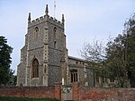
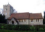
Anstey is a village and civil parish in the East Hertfordshire district of Hertfordshire, England, about 15 miles (24 km) northeast of Stevenage. According to the 2001 census the population of the parish was 338, reducing to 299 at the 2011 census.The name "Anstey" derives from the Old English ān (narrow, or one-way) and stīg (footpath).There are at least two books on the history of this village. The first is Anstey, a Hertfordshire Parish, written in 1929 by Rev Frank Ricardo Williams, MA, who was the rector from 1907 to 1928 (died 19 May 1937). The second is Anstey: Our True Surname Origin and Shared Medieval Ancestry by GM Anstey and TJ Anstey in which it is shown that all bearers of the surname 'Anstey' worldwide can trace their surname origin to Anstey in Hertfordshire. The Church of England parish church of Saint George is a cruciform building of flint with stone dressings. Its earliest parts are the chancel, transepts and crossing tower, all of which were built in the 12th century. The church was altered in the 13th century and the nave was rebuilt in the 14th century. The south porch and the top stage of the tower are 15th century. The church was restored in 1871–72 under the direction of the Gothic Revival architect William Butterfield. Repairs in 1907 were directed by the architect Arthur Blomfield. St George's is a Grade I listed building. The lychgate is a separate Grade II listed building, as it incorporates a lockup which was apparently used until the beginning of the 20th century.In his book 'England's Thousand best churches' (revised edition 2002), Simon Jenkins refers to a near-miss when a fully-loaded WW2 bomber nearly crashed into the church. This is reference to the crash of a Flying Fortress which crashed on take-off en route to Cologne: all ten crew were killed. Jenkins refers to the church as 'full of Norman mystery'. He pays particular interest to the church font, in which (and very unusually) four mermen are carved into the stone. Jenkins refers to the carvings as '...the rarest of pagan emblems'. A folk tale tells of a fiddler from Anstey named Blind George, who disappeared while exploring an underground passage. He is said to have entered the tunnel playing his fiddle, which could be heard above ground. He stopped suddenly, and screams were heard, and he was not seen again.The village has a pub, The Blind Fiddler, which used to be called The Chequers.

Nuthampstead

Nuthampstead is a small village and civil parish in North East Hertfordshire located a few miles south of the town of Royston. In the 2001 census the parish had 139 residents, increasing to 142 at the 2011 Census.Nuthampstead was historically a hamlet in the parish of Barkway. The hamlet appointed its own overseer of the poor, and as such became an separate civil parish on 10 August 1866 under the Poor Law Amendment Act 1866. Despite becoming a separate civil parish, it remains part of the ecclesiastical parish of Barkway. Nuthampstead was included in the Royston Poor Law Union from 1835. It formed part of the Ashwell Rural District from 1894 until 1935, when that district was absorbed into the Hitchin Rural District. Since 1974, Nuthampstead has been part of North Hertfordshire. Due to its small size, Nuthampstead has a parish meeting rather than a parish council.During the Second World War, RAF Nuthampstead, situated next to the village, was home initially to the 55th Fighter Group and subsequently the 398th Bombardment Group of the U.S. Army Air Forces. This latter unit, the base's primary occupant, flew Boeing B-17 Flying Fortress heavy bombers on missions over occupied Europe.Known as USAAF Station 131 during the war, and less formally as AAF Nuthampstead, the airfield was constructed by U.S. Army engineer battalions starting in 1942. The site was formerly Scales Park, which was planted with oak trees after the Battle of Trafalgar. These were cleared to make room for the runways, hangars, and other wartime facilities. Visitors to the site will find that the main runways have since been removed, with a grass runway and service roads only remaining to allow the airfield to be used by light aircraft. In 1968–71 the Commission on the Third London Airport (the "Roskill Commission") considered Nuthampstead as one of its four short-listed sites, along with Cublington, Foulness (later known as Maplin Sands) and Thurleigh.Barkway VOR is located at Nuthampstead Airfield.Areas of the former airfield have been converted into a shooting ground. Since 1992, when planning permission was granted, the ground has developed to enable it to hold major championships in four international shooting disciplines.The village has a pub/restaurant with bed and breakfast facilities, called The Woodman Inn. Outside The Woodman Inn is a large memorial stone dedicated to the 398th squadron, and a museum of the airfield's history.

Hare Street House
Hare Street House

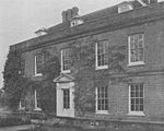
Hare Street House is a Grade II* listed building in the hamlet of Hare Street that lies between Buntingford and Great Hormead in the East Hertfordshire district of Hertfordshire, England. It is mainly associated with the Roman Catholic priest and writer Robert Hugh Monsignor Benson, who owned the house from 1906 until his death in 1914.The earliest parts of the building date from the late 16th or early 17th century. The brick frontage was added in the early 18th century, possibly for William Benn (Sheriff of Hertfordshire and Lord Mayor of London in 1747). The house was in disrepair when Benson saw it in 1903 and purchased it for "an extraordinarily low sum". Benson carried out many internal alterations, with the help of the artist Gabriel Pippet. Monsignor Benson left Hare Street House to the Archdiocese of Westminster following his death. It has been used as a country retreat for the archbishop and remained under the ownership of the archdiocese until 2019. Further restoration was carried out in 1962 for William Cardinal Godfrey who had earlier appointed the poet and mystic John Bradburne to be caretaker.A charitable trust "to generate income for the upkeep and repair of Hare Street House" was maintained by the Archdiocese of Westminster. Cardinal Hinsley died at Hare Street House in 1943.It was reported in 2018 that the archdiocese could no longer afford the upkeep and was putting the property up for sale. It was sold in October 2019. A 17th century brewhouse in the grounds was converted to a chapel by Benson. This too has listed status as do the gates to the grounds. A further chapel stands in the grounds of the house, built over the former grave of Monsignor Benson and dedicated to St Hugh. The Benson Memorial Church, dedicated to St Richard of Chichester, is a Roman Catholic church in Buntingford. Benson helped fund construction of the church and laid the foundation stone but died before the building was completed.

River Quin
River Quin

The River Quin is a small watercourse which rises near Barkway in north east Hertfordshire, England. The river is fed by a number of sources including springs from Biggin Moor, Great Hormead Brook, Little Hormead Brook and various field ditches, including the Braughing Bourne - the site of a former glacier from the Ice Age. It flows south, close to the B1368 road to the southwest of Braughing where it joins the River Rib at Gatesbury. This area was the site of a former Roman settlement. Until recently the river was diverted at this point to irrigate watercress beds before flowing into the Rib. The Quin Valley also includes the villages of Hare Street and Great Hormead as well as the smaller settlements of Hay Street and Dassels. The valley is shallow around the river with gently sloping sides at the northern end, becoming slightly narrower with steeper sides at the southern end of the area. Its sides are dominated by open arable farmland in small to medium fields with some occasional large fields particularly at the northern end. There is an absence of woodland and few mature trees grow alongside the river.In Braughing, there are two ford crossings, one at Sheeps Lane and the other at Maltings Lane. The river is prone to severe flooding after heavy rain, rendering the fords impassable, particularly in the autumn and winter months. In 1922, a donkey and cart were swept away when its owner tried in vain to cross Sheeps Lane Ford. The animal was drowned.

Wyddial
Wyddial

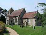
Wyddial is a village and civil parish in the East Hertfordshire district of Hertfordshire, England. It is located around a mile and a half north-east of Buntingford (OS grid reference TL 373 317), and lies due north of Greenwich on the Prime Meridian. The place name is first attested in the Domesday Book of 1086, where it appears as Widihale, and means 'willow nook'. The parish church of St Giles dates from the 14th century when the nave was built. The tower and chancel date from the 15th century. In 1859 the nave was restored and the chancel and south porch rebuilt by Baillie & Co.Wyddial Hall is a Grade II* listed building, which was originally built in the early 16th century. The hall is situated just north of the church and has access via the churchyard. In 1733 it was remodelled after a damaging fire for Francis Goulston. By 1780 it had been acquired by John Thomas Ellis, MP for Lostwithiel, who made alterations, and later changes were made by Charles Heaton-Ellis. Admiral Edward Heaton-Ellis, who fought in the Battle of Jutland in 1916, was born at Wyddial. The Hall was used as accommodation for the Women's Land Army during the 1939-45 war. Sir Charles Heaton Ellis sold the surrounding farmland to the Hodge family in the 1930s. On his death in 1946 the Hall was bought by William and Christina Gibson, then in 1964 by Mrs Jennifer Boyd-Carpenter, the ecclesiastical embroiderer, and her husband Michael, a member of the Stock Exchange. The house was sold in 1995 to Michael Hatchard, an international lawyer.