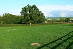
Durocornovium
1st-century establishments in Roman BritainArchaeological sites in WiltshireRoman towns and cities in England

Durocornovium was a Roman town in Britain, situated on the Roman road between Corinium Dobunnorum (Cirencester) and Calleva Atrebatum (Silchester). In many ways Durocornovium was a typical small Roman town.
Excerpt from the Wikipedia article Durocornovium (License: CC BY-SA 3.0, Authors, Images).Durocornovium
A419,
Geographical coordinates (GPS) Address Nearby Places Show on map
Geographical coordinates (GPS)
| Latitude | Longitude |
|---|---|
| N 51.568 ° | E -1.723 ° |
Address
A419
SN3 5DL
England, United Kingdom
Open on Google Maps


