place

Oak Ridge, New Jersey

Census-designated places in Morris County, New JerseyCensus-designated places in New JerseyCensus-designated places in Passaic County, New JerseyJefferson Township, New JerseyUnincorporated communities in Morris County, New Jersey
Unincorporated communities in New JerseyUnincorporated communities in Passaic County, New JerseyUse American English from March 2023Use mdy dates from March 2023West Milford, New Jersey
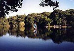
ALFRED T. RINGLING MANOR, OAK RIDGE, MORRIS COUNTY

Oak Ridge is an unincorporated community and census-designated place (CDP) located along the border of West Milford Township in Passaic County and Jefferson Township in Morris County, in the U.S. state of New Jersey. The area is served as United States Postal Service ZIP Code 07438. As of the 2000 United States census, the population for ZIP Code Tabulation Area 07438 was 11,901. Oak Ridge is located on the Pequannock River along Route 23 and the New York, Susquehanna & Western Railroad main line. County Route 699 (Oak Ridge Road) runs south from the junction with Route 23 and is the main north–south local route in the community. As of 2018, in the section in Jefferson Township, the people there state they are from "Milton".

Excerpt from the Wikipedia article Oak Ridge, New Jersey (License: CC BY-SA 3.0, Authors, Images).

Oak Ridge, New Jersey
Oak Ridge Road,

Geographical coordinates (GPS) Address Nearby Places
placeShow on map

Wikipedia: Oak Ridge, New JerseyContinue reading on Wikipedia

Geographical coordinates (GPS)

Latitude Longitude
N 41.046111111111 ° E -74.486111111111 °
placeShow on map

Address

Oak Ridge Road 362
07438
New Jersey, United States
mapOpen on Google Maps

ALFRED T. RINGLING MANOR, OAK RIDGE, MORRIS COUNTY
Share experience

Nearby Places

New York–New Jersey Highlands

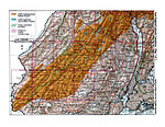
The New York – New Jersey Highlands is a geological formation composed primarily of Precambrian igneous and metamorphic rock running from the Delaware River near Musconetcong Mountain, northeast through the Skylands Region of New Jersey along the Bearfort Ridge and the Ramapo Mountains, Sterling Forest, Harriman and Bear Mountain State Parks in New York, to the Hudson River at Storm King Mountain. The northern region is also known as the Hudson Highlands and the southern as the New Jersey Highlands. A broader definition would extend the region west to Reading, Pennsylvania, and east to the Housatonic River in Connecticut, encompassing the Reading Prong. The highlands are a subrange of the Appalachian Mountains. In New Jersey, the region's watershed is protected by the state's own Highlands Water Protection and Planning Act (2004). In addition to preserving water resources, the act created the New Jersey Highlands Water Protection and Planning Council (NJ Highlands Council) whose mission includes supporting open space preservation and the creation of new recreational parks and hiking trails in America's most densely populated state. These include the Highlands Trail, designated as a Millennium Trail by the White House Millennium Council and maintained by the New York-New Jersey Trail Conference. The New Jersey Highlands Coalition was formed in 1988 to protect the resources of the region.In November 2004, the federal Highlands Conservation Act was passed. The Highlands Conservation Act “recognizes the importance of the water, forest, agricultural, wildlife, recreational, and cultural resources of the Highlands region, and the national significance of the Highlands region to the United States.”

Green Pond, New Jersey

Green Pond is a private lakeside residential unincorporated community within Rockaway Township in Morris County, New Jersey, United States. The lakeside community is managed by two corporations, Green Pond Corporation and Lake End Corporation. Green Pond is located in Rockaway Township in Morris County, but has a Newfoundland (Passaic County) mailing address. Newfoundland came to wider attention in 2003 when large portions of the independent film, The Station Agent, were filmed there. Several scenes of this film took place on Green Pond Road (County Route 513), a public thoroughfare which connects a former New York, Susquehanna and Western Railway depot and Route 23 to Lake End Road and to the private lanes of the Green Pond Village community. Lakeside scenes of The Station Agent that were set on Green Pond were actually filmed elsewhere, as the Lake End and Green Pond Corporations denied lake access to the filmmakers. New homeowners in either Green Pond or Lake End Corporations pay a fee to the relevant corporation in addition to the usual real estate closing fees, and become "stockholders" in exchange for an interest in the common lands which surround the community. Only stockholders and their guests (who are required to wear ID) may access the lake and the community facilities, which include tennis courts, ballfields, a community center, and a membership-only yacht club that races Comet sailboats. On summer weekends and major holidays, a security guard is stationed at the entrance to Green Pond village to prevent unauthorized access to the beach areas.

Clinton Road (New Jersey)

Clinton Road is located in West Milford, Passaic County, New Jersey. It runs in a generally north-south direction, beginning at Route 23 near Newfoundland and running roughly 10 miles (16 km) to its northern terminus at Upper Greenwood Lake. The road and the land around it have gained notoriety over the years as an area rife with many legends of paranormal occurrences such as sightings of ghosts, strange creatures, and gatherings of witches, Satanists, and the Ku Klux Klan. It is also rumored that professional killers dispose of bodies in the surrounding woods—with one recorded case of this occurring. It has been a regular subject of discussion in Weird NJ magazine, which once devoted an entire issue to it. In the words of a local police chief, "It's a long, desolate stretch and makes the imagination go nuts."There are very few houses along the road and much of the adjoining property is undeveloped publicly owned woodlands (either City of Newark watershed or state forest) and the road itself is a narrow two-lane highway that receives little maintenance, is not part of New Jersey's county route system and was until fairly recently unpaved for some of its length, connecting two areas of minimal population and growth and thus having little traffic even at the busiest times of day. It is also notorious for having the country's longest traffic light wait. This occurs at a double intersection where Route 23 crosses the road. The two lights can cause motorists to wait for 5 minutes in total. The lengthy wait was a result of traffic planners giving increased priority to Route 23 to reduce backups during rush hour.