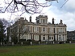
Beaulieu Heights

Beaulieu Heights (locally BEW-lə) 16 acres (6.5 ha) is an area of ancient woodland between South Norwood and Upper Norwood in the London Borough of Croydon, London. It is located between South Norwood Hill and Auckland Road with Auckland Rise to the north and Tummonds Gardens to the south. There are pedestrian entrances from South Norwood Hill and Auckland Rise, and a pond. The name is pronounced as if spelled "Beulah" like the nearby Beulah Hill, and not like the French word or the town of Beaulieu, Hampshire. The wood is a remnant of The Great North Wood and is currently managed by The London Wildlife Trust along with Croydon Council as a part of its Great North Wood Project.
Excerpt from the Wikipedia article Beaulieu Heights (License: CC BY-SA 3.0, Authors, Images).Beaulieu Heights
Auckland Rise, London Upper Norwood (London Borough of Croydon)
Geographical coordinates (GPS) Address Nearby Places Show on map
Geographical coordinates (GPS)
| Latitude | Longitude |
|---|---|
| N 51.41 ° | E -0.084 ° |
Address
Auckland Rise
Auckland Rise
SE19 2DZ London, Upper Norwood (London Borough of Croydon)
England, United Kingdom
Open on Google Maps


