place

Kellington

Civil parishes in North YorkshireSelby DistrictUse British English from January 2018Villages in North Yorkshire
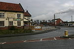
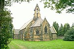
Kellington Centre geograph.org.uk 159456

Kellington is a small village and civil parish in the Selby District of North Yorkshire, England, on the banks of the River Aire. Situated almost equidistant between the towns of Pontefract and Selby, the village dates back to at least the 11th century when it was listed in the Domesday Book (as Chelinctone). The semi-rural community grew in size with the advent of local mining as housing was built to accommodate the workers of nearby Kellingley Colliery. The village was historically part of the West Riding of Yorkshire until 1974.Due to its location at the southernmost tip of North Yorkshire, the village is close to the borders of West, East and South Yorkshire. Its proximity to both the A19 and M62 major roads has resulted in a steady population growth, although to a lesser extent than its neighbour, Eggborough. The low-lying ground that separates the village from the River Aire has given rise to a history of flooding the surrounding farmland, most recently in 2000.

Excerpt from the Wikipedia article Kellington (License: CC BY-SA 3.0, Authors, Images).

Kellington
Eastfield Lane,

Geographical coordinates (GPS) Address Nearby Places
placeShow on map

Wikipedia: KellingtonContinue reading on Wikipedia

Geographical coordinates (GPS)

Latitude Longitude
N 53.7182 ° E -1.166 °
placeShow on map

Address

Eastfield Lane

Eastfield Lane
DN14 0NL , Kellington
England, United Kingdom
mapOpen on Google Maps

Kellington Centre geograph.org.uk 159456
Share experience

Nearby Places

St Mary's Church, Birkin

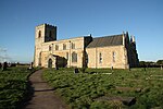
St Mary's Church is the parish church of Birkin, a village in North Yorkshire, in England. The church was built in the 12th century, and survives largely intact from the period. A south aisle was added in the 14th century, when the top stage of the tower was also added. The church was restored in 1882 by John Oldrid Scott. It was Grade I listed in 1967. The church is built of limestone with a stone slate roof, and has a wooden porch. It consists of a two-bay nave with a south aisle, a chancel and apse, and a west tower. The tower has two stages, slits in the lower stage, bands, the upper one with gargoyles, two-light bell openings, and an embattled parapet with pinnacles. On the south front is a later timber porch, and a Norman doorway of four orders with various carvings, and three colonnettes with capitals decorated with interlace and scallops. The nave has an embattled parapet, and around the body of the church is a corbel table with carvings including humans, masks, and animals. There are a variety of windows, some square headed, some round headed, and the east window has three lights and tracery. The east window of the south aisle has some 14th century stained glass. Inside the church is a 14th-century effigy of a man holding his heart in his hand. There is a 14th-century grave slab in the south aisle, and some 17th and 18th century monuments. There is a piscina in the south aisle with an ogee arch, and the font is dated 1663, but on an earlier base. In the churchyard is a Roman coffin, which is Grade II listed.