place

Beal, North Yorkshire

Civil parishes in North YorkshireSelby DistrictUse British English from March 2015Villages in North Yorkshire
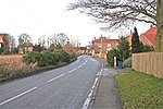
River Aire, Beal
River Aire, Beal

Beal is a village and civil parish in North Yorkshire, England. It is situated on the River Aire, 3.5 miles (6 km) north-east of Knottingley, 8 miles (13 km) south-west of Selby, and 21 miles (34 km) south of York. The parish includes the village of Kellingley, and borders the City of Wakefield in West Yorkshire. At the 2001 census it had a population of 720, increasing to 738 at the 2011 census.

Excerpt from the Wikipedia article Beal, North Yorkshire (License: CC BY-SA 3.0, Authors, Images).

Beal, North Yorkshire
Marsh Lane,

Geographical coordinates (GPS) Address Nearby Places
placeShow on map

Wikipedia: Beal, North YorkshireContinue reading on Wikipedia

Geographical coordinates (GPS)

Latitude Longitude
N 53.723 ° E -1.194 °
placeShow on map

Address

The Kings Arms

Marsh Lane
DN14 0SL
England, United Kingdom
mapOpen on Google Maps

River Aire, Beal
River Aire, Beal
Share experience

Nearby Places

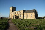
St Mary's Church, Birkin

St Mary's Church is the parish church of Birkin, a village in North Yorkshire, in England. The church was built in the 12th century, and survives largely intact from the period. A south aisle was added in the 14th century, when the top stage of the tower was also added. The church was restored in 1882 by John Oldrid Scott. It was Grade I listed in 1967. The church is built of limestone with a stone slate roof, and has a wooden porch. It consists of a two-bay nave with a south aisle, a chancel and apse, and a west tower. The tower has two stages, slits in the lower stage, bands, the upper one with gargoyles, two-light bell openings, and an embattled parapet with pinnacles. On the south front is a later timber porch, and a Norman doorway of four orders with various carvings, and three colonnettes with capitals decorated with interlace and scallops. The nave has an embattled parapet, and around the body of the church is a corbel table with carvings including humans, masks, and animals. There are a variety of windows, some square headed, some round headed, and the east window has three lights and tracery. The east window of the south aisle has some 14th century stained glass. Inside the church is a 14th-century effigy of a man holding his heart in his hand. There is a 14th-century grave slab in the south aisle, and some 17th and 18th century monuments. There is a piscina in the south aisle with an ogee arch, and the font is dated 1663, but on an earlier base. In the churchyard is a Roman coffin, which is Grade II listed.

Mary Towneley Loop
Mary Towneley Loop

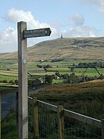
The Mary Towneley Loop is a 47-mile (76 km) circular route that forms part of the Pennine Bridleway National Trail, along the borders of Lancashire and Yorkshire. The loop was opened in 2002, the first section of the Pennine Bridleway.It is named in memory of Mary, Lady Towneley, who drew attention to the poor state of England's bridleways and the need for a long-distance route for horse-riders by riding with two friends in September 1986 from Hexham in Northumberland to Ashbourne in Derbyshire. She died in 2001. The route joins the main Pennine Bridleway at two points, one near the village of Summit between Littleborough and Todmorden, and one just east of Worsthorne. Heading west from Summit the Loop climbs to Top of Leach at 474 metres (1,555 ft). The trail then passes through the town of Waterfoot in the Rossendale Valley and follows new tracks via Lumb before entering the Cliviger Gorge and then climbing up to the Long Causeway. It then heads north to rejoin the main Pennine Bridleway just east of Worsthorne. The Loop then follows the main route to enter West Yorkshire at Widdop, crosses Heptonstall Moor and drops down to cross the Calder Valley just west of the town of Hebden Bridge. The trail passes the villages of Mankinholes and Bottomley to return to Summit. An annual relay race, organized by Rossendale Harriers, took place in late January or early February until 2011. Teams consisting of five pairs of runners race over five relay legs completed the entire 47 miles and 6,400 feet of ascent of the loop, clockwise from Fearns Sports College in Stacksteads. The last race in 2011 took place on 30 January and hosted 109 teams, 1,090 individual runners from clubs across the north of England, and was won by Salford Harriers.