place

Model Tobacco Building

Art Deco architecture in VirginiaBuildings and structures in Richmond, VirginiaOffice buildings completed in 1940Tobacco buildings in the United States
Model Tobacco Building, Richmond, Virginia

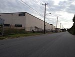
Built from 1938-40, the Art Deco style Model Tobacco Building is the primary six-story building of a six building collection of buildings comprising a former tobacco factory. Located at 1100 Jefferson Davis Highway (U.S. Route 1), in Richmond, Virginia, the building was designed by the Chicago architecture firm of Schmidt, Garden and Erikson and is known for the 9' tall Moderne MODEL TOBACCO letters which dominate the north end of the building. It is one of many Art Deco buildings in Richmond, including assorted buildings on Grace Street including the Central National Bank building, the Virginia Union Belgian Building, Medical College of Virginia's West Hospital, Henrico Theatre, Thomas Jefferson High School (Richmond, Virginia), and Nolde Bakery, 306-308 North 26th Street, and the Patrick Henry Building on 1111 E. Board Street built in 1938-40. Currently the building houses approximately 3.5 acres (14,000 m2) of used cubicle partitions and other miscellaneous office furniture.

Excerpt from the Wikipedia article Model Tobacco Building (License: CC BY-SA 3.0, Authors, Images).

Model Tobacco Building
Richmond Highway, Richmond Manchester

Geographical coordinates (GPS) Address External links Nearby Places
placeShow on map

Wikipedia: Model Tobacco BuildingContinue reading on Wikipedia

Geographical coordinates (GPS)

Latitude Longitude
N 37.504777777778 ° E -77.4476 °
placeShow on map

Address

Richmond Highway 1100
23224 Richmond, Manchester
Virginia, United States
mapOpen on Google Maps

linkWikiData (Q6888288)
linkOpenStreetMap (762669370)

Model Tobacco Building, Richmond, Virginia
Share experience

Nearby Places

Manchester, Richmond, Virginia

Manchester is a former independent city in Virginia in the United States. Prior to receiving independent status, it served as the county seat of Chesterfield County, between 1870 and 1876. Today, it is a part of the city of Richmond, Virginia. Originally known as Manastoh and later Rocky Ridge, it was located on the south bank of the James River at the fall line opposite the state capital city of Richmond, on the north side of the river. Manchester was an active port city, and was a port of entry for slave ships principally in the 18th century. The port shipped out tobacco and coal which was transported 13 miles overland from the Midlothian-area mines on the Midlothian Turnpike, first paved toll road in Virginia in 1807, and the Chesterfield Railroad, the state's first in 1831. Manchester became an incorporated town in 1769 and an independent city in 1874. In 1910, it merged by mutual agreement with the larger state capital City of Richmond, achieving another "first" as the earliest of Virginia's independent cities to lose its identity. Today, "Old Manchester" is considered a neighborhood of Richmond. Many vestiges of its past are clearly visible, notably the courthouse, the Hull Street business district, a number of historic houses, and several former railroad and street railway buildings. As part of the community's African American heritage, a "slave trail" traces the route into the downtown area from where the slave ships docked along the river. Interstate 95, and four other major highways, U.S. Routes 1, 60, 301 and 360 all cross the James River and enter downtown Richmond from Manchester.