place

29th federal electoral district of the State of Mexico

Federal electoral districts of MexicoPolitics of the State of Mexico
Federal Electoral Districts of Mexico (state) (since 2022)

The 29th federal electoral district of the State of Mexico (Spanish: Distrito electoral federal 29 del Estado de México) is one of the 300 electoral districts into which Mexico is divided for elections to the federal Chamber of Deputies and one of 40 such districts in the State of Mexico. It elects one deputy to the lower house of Congress for each three-year legislative session by means of the first-past-the-post system. Votes cast in the district also count towards the calculation of proportional representation ("plurinominal") deputies elected from the fifth region. The 29th district was created by the 1977 electoral reforms, which increased the number of single-member seats in the Chamber of Deputies from 196 to 300. Under that plan, the State of Mexico's seat allocation rose from 15 to 34. The new districts were first contended in the 1979 mid-term election.

Excerpt from the Wikipedia article 29th federal electoral district of the State of Mexico (License: CC BY-SA 3.0, Authors, Images).

29th federal electoral district of the State of Mexico
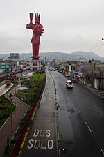
Calle Iztapalapa, Nezahualcóyotl

Geographical coordinates (GPS) Address Nearby Places
placeShow on map

Wikipedia: 29th federal electoral district of the State of MexicoContinue reading on Wikipedia

Geographical coordinates (GPS)

Latitude Longitude
N 19.4 ° E -99.016666666667 °
placeShow on map

Address

Calle Iztapalapa

Calle Iztapalapa
57740 Nezahualcóyotl
State of Mexico, Mexico
mapOpen on Google Maps

Federal Electoral Districts of Mexico (state) (since 2022)
Share experience

Nearby Places

Ciudad Nezahualcóyotl

Nezahualcóyotl (Spanish pronunciation: [sjuˈðað nesawalˈkoʝotl]), or more commonly Neza, is a city and municipal seat of the municipality of Nezahualcóyotl in Mexico. It is located in the state of Mexico, adjacent to the east side of Mexico City. The municipality comprises its own intrastate region, Region IX (Mexico State). It was named after Nezahualcoyotl, the Acolhua poet and king of nearby Texcoco, which was built on the drained bed of Lake Texcoco. The name Nezahualcóyotl comes from Nahuatl, meaning "fasting coyote". Nezahualcóyotl's heraldry includes an Aztec glyph as well as a coat of arms. The glyph depicts the head of a coyote, tongue outside the mouth with a collar or necklace as a symbol of royalty (one of the ways of depicting the Aztec king). The current coat of arms, which includes the glyph, was authorized by the municipality in the 1990s.Until the 20th century, the land on which Ciudad Neza sits was under Lake Texcoco and uninhabited. Successful draining of the lake in the early 20th century created new land, which the government eventually sold into private hands. However, public services such as adequate potable water, electricity and sewerage were lacking until after the area was made an independent municipality in 1963. Today, Ciudad Neza is a sprawling city of over one million, entirely with modern buildings. As of 2006, Nezahualcóyotl includes part of the world's largest shanty town, along with Chalco and Ixta. Most of its population is poor and have migrated from other parts of Mexico. It also has a very high crime rate, in part due to cholos, gangs that formed in the 1990s based upon gangs in the United States (especially Los Angeles). Since the 2000s, a significant number of natives of this city have immigrated to the United States, mostly settling in New York. This has led to a new Mexican subculture in the area.