place

Coyote en Ayuno

2008 establishments in Mexico2008 sculpturesAnimal sculptures in MexicoCiudad NezahualcóyotlOutdoor sculptures in the State of Mexico
Sculptures of mammalsSteel sculptures in MexicoUse American English from August 2022
Coyote en ayuno (Nezahualcóyotl, Edomex)

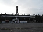
Coyote en Ayuno ("Fasting Coyote"), also known as Coyote Hambriento ("Hungry Coyote") and Cabeza de Coyote ("Coyote Head"), is an outdoor steel sculpture by abstract monumental artist Enrique "Sebastián" Carbajal, installed on a roundabout in the intersection of Adolfo López Mateos Avenue and Pantitlán Avenue, in the municipality of Nezahualcóyotl, State of Mexico. The sculpture, which depicts a red coyote looking skyward, was inaugurated on 23 April 2008 to celebrate the 45th anniversary of the founding of the municipality. The name of the sculpture references the etymology of Nezahualcóyotl.

Excerpt from the Wikipedia article Coyote en Ayuno (License: CC BY-SA 3.0, Authors, Images).

Coyote en Ayuno
Nezahualcóyotl

Geographical coordinates (GPS) Address Nearby Places
placeShow on map

Wikipedia: Coyote en AyunoContinue reading on Wikipedia

Geographical coordinates (GPS)

Latitude Longitude
N 19.4 ° E -99.028888888889 °
placeShow on map

Address


Nezahualcóyotl
State of Mexico, Mexico
mapOpen on Google Maps

Coyote en ayuno (Nezahualcóyotl, Edomex)
Share experience

Nearby Places

Ciudad Nezahualcóyotl

Nezahualcóyotl (Spanish pronunciation: [sjuˈðað nesawalˈkoʝotl]), or more commonly Neza, is a city and municipal seat of the municipality of Nezahualcóyotl in Mexico. It is located in the state of Mexico, adjacent to the east side of Mexico City. The municipality comprises its own intrastate region, Region IX (Mexico State). It was named after Nezahualcoyotl, the Acolhua poet and king of nearby Texcoco, which was built on the drained bed of Lake Texcoco. The name Nezahualcóyotl comes from Nahuatl, meaning "fasting coyote". Nezahualcóyotl's heraldry includes an Aztec glyph as well as a coat of arms. The glyph depicts the head of a coyote, tongue outside the mouth with a collar or necklace as a symbol of royalty (one of the ways of depicting the Aztec king). The current coat of arms, which includes the glyph, was authorized by the municipality in the 1990s.Until the 20th century, the land on which Ciudad Neza sits was under Lake Texcoco and uninhabited. Successful draining of the lake in the early 20th century created new land, which the government eventually sold into private hands. However, public services such as adequate potable water, electricity and sewerage were lacking until after the area was made an independent municipality in 1963. Today, Ciudad Neza is a sprawling city of over one million, entirely with modern buildings. As of 2006, Nezahualcóyotl includes part of the world's largest shanty town, along with Chalco and Ixta. Most of its population is poor and have migrated from other parts of Mexico. It also has a very high crime rate, in part due to cholos, gangs that formed in the 1990s based upon gangs in the United States (especially Los Angeles). Since the 2000s, a significant number of natives of this city have immigrated to the United States, mostly settling in New York. This has led to a new Mexican subculture in the area.

Pantitlán metro station

Pantitlán (Spanish: [pantiˈtlan] (listen); Nahuatl transl. "Between flags") is a Mexico City Metro transfer station in the boroughs of Iztacalco and Venustiano Carranza, in Mexico City. It is a combined underground, at-grade, and elevated station with six island platforms and two side platforms, served by Lines 1 (the Pink Line), 5 (the Yellow Line), 9 (the Brown Line), and A (the Purple Line). The only quadra-line interchange station in the system, Pantitlán station works as the terminal station of all of the lines and is located adjacent to Zaragoza (Line 1), Hangares (Line 5), Puebla (Line 9), and Agrícola Oriental (Line A). It serves the colonias (neighborhoods) of Ampliación Adolfo López Mateos, Aviación Civil, and Pantitlán; it receives its name from the last one. The station's pictogram features the silhouettes of two flagpoles. Pantitlán station opened on 19 December 1981 with service northwestward toward Consulado on Line 5; service eastward toward Observatorio on Line 1 started on 22 August 1984; service eastward toward Centro Médico on Line 9 started on 26 August 1987; and service southeastward toward La Paz on Line A started on 12 August 1991. The facilities are accessible to the disabled. Inside there is a cultural display, an Internet café, a women's defense module, a public ministry office, a health module, a mural, and a bicycle parking station. By far, Pantitlán is the busiest station in the system. In 2019, the station had a ridership of 132,845,471 passengers, whereas the second place (Cuatro Caminos) registered 39,378,128 passengers. Out of those, 45,550,938 entrances were registered on Line A, making it the busiest station when counted separately.