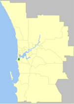
East Fremantle, Western Australia

East Fremantle (nicknamed East Freo) is a suburb of Perth, Western Australia, located 13 kilometres (8.1 mi) south-west of the central business district. The suburb is mainly residential, and is coterminous with the Town of East Fremantle local government area. Previously serving as an outer, rural area of Fremantle, most of the present-day suburb was originally developed in the late 1890s and early 1900s as a result of the Western Australian gold rushes. Further development occurred in the late 1940s and 1950s to provide dwellings for new immigrants. Two major arterial roads – Canning Highway and Stirling Highway – pass through the suburb, which is also bounded to the north by the Swan River.
Excerpt from the Wikipedia article East Fremantle, Western Australia (License: CC BY-SA 3.0, Authors, Images).East Fremantle, Western Australia
Wolsely Road, Town Of East Fremantle
Geographical coordinates (GPS) Address Nearby Places Show on map
Geographical coordinates (GPS)
| Latitude | Longitude |
|---|---|
| N -32.0366967 ° | E 115.767731 ° |
Address
Wolsely Road
Wolsely Road
6158 Town Of East Fremantle, East Fremantle
Western Australia, Australia
Open on Google Maps


