place

Dishley, Hathern and Thorpe Acre, Loughborough

Areas of LoughboroughBorough of CharnwoodUse British English from October 2014Wards of Leicestershire
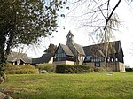
Hathern church geograph.org.uk 4792881

Dishley, Hathern and Thorpe Acre (sometimes referred to as Dishley and Hathern) is a ward of Loughborough in Leicestershire, England.

Excerpt from the Wikipedia article Dishley, Hathern and Thorpe Acre, Loughborough (License: CC BY-SA 3.0, Authors, Images).

Dishley, Hathern and Thorpe Acre, Loughborough
Derby Road, Charnwood Hathern

Geographical coordinates (GPS) Address Nearby Places
placeShow on map

Wikipedia: Dishley, Hathern and Thorpe Acre, LoughboroughContinue reading on Wikipedia

Geographical coordinates (GPS)

Latitude Longitude
N 52.788305 ° E -1.249447 °
placeShow on map

Address

Derby Road

Derby Road
LE12 5JS Charnwood, Hathern
England, United Kingdom
mapOpen on Google Maps

Hathern church geograph.org.uk 4792881
Share experience

Nearby Places

Thorpe Acre
Thorpe Acre

Thorpe Acre is an area of Loughborough, Leicestershire. Until the mid-twentieth century, it was a hamlet of about twenty houses or cottages, several of which survive. There is also a nineteenth-century church with contemporary extensions, All Saints Church Thorpe Acre with Dishley (not to be confused with All Saints Church in Loughborough town centre), as well as an old hostelry, The Plough Inn. The population is included in the Loughborough-Garendon and Loughborough Ashby Wards of Charnwood Borough Council. Following the Second World War, Loughborough needed more housing and part of Thorpe Acre was developed, largely for employees of Brush Engineering Works, during the 1950s. A new shopping area with a selection of local shops, now known colloquially as The Ville, was built. It was at this time that the village green was created; the area where the green is was formerly built-up. In the 1960s and early 1970s, Thorpe Acre was chosen for a large new housing estate; these developments have completely subsumed the old village. Two of Loughborough's secondary schools, Charnwood College and De Lisle College are located on the edge of the estate, as well as Maplewell Hall and Ashmount special schools. In recent years, the council estates have suffered from crime problems and antisocial behaviour not unlike such problems experienced on many council estates up and down the United Kingdom. The area lies on the boundary of Garendon Park, one of the great Leicestershire deer parks of the eighteenth century. All Saints Church, Thorpe Acre with Dishley, was built in 1845 and extended in 1965. Dishley Church is now a ruin on the Derby Road, Loughborough. Robert Bakewell (1726–1795), the agriculturalist, is buried there.Thorpe Acre has a men's football team, established in 2017, which plays in the North Leicestershire Football League and is managed by Declan Bestwick.

Stonebow Village
Stonebow Village

Stonebow Village is a civil parish in Borough of Charnwood, Leicestershire, England. In 2021 the parish had a population of 9. The parish was created on 1 April 2019, from parts of the parishes of Shepshed and Hathern and part of the unparished area of Loughborough. It is bordered to the west by the parish of Shepshed (the M1 motorway forming the boundary), to the north by Hathern, and to the east and south by Loughborough. The Garendon Park Development, also known as the West of Loughborough Sustainable Urban Extension, is a proposed development of 3,200 houses, with associated shopping facilities, schools, sporting facilities and employment areas, in the parish. It received outline planning permission in July 2018, and as of 2024 is being marketed by its developers under the name Garendon Country Park. As of October 2024 there are 13 listed buildings (the Triumphal Arch at grade I, the Temple of Venus at grade II* and 11 at grade I), one listed park and garden (Garendon at grade II), and one scheduled monument (the remains of the Cistercian Garendon Abbey) in the parish. All are within Garendon Park, the grounds of the former Garendon Hall. The highest point in the parish is Bellevue Hill at 68 m (223 ft), in the north, which has been described as "offer[ing] stunning panoramic views of the surrounding countryside". Stonebow Primary School, despite its name, is not in the parish of Stonebow Village but is in an adjacent unparished area of Loughborough.