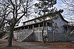
Milford Point

Milford Point is a 23-acre (0.093 km2) barrier beach on the shoreline of Milford, Connecticut. The long peninsula is the southwest extremity of the city, located at the mouth of the Housatonic River on Long Island Sound. A sandspit landform, the Point serves as a fortress, protecting the Charles Wheeler Salt Marsh (WMA), a tidal wetland and habitat to 315 different species of waterfowl, shorebirds, and waders. Milford Point is considered one of Connecticut's top birdwatching destinations, as the environment provides foraging and resting areas for tens of thousands of shorebirds each year, making it one of the most essential migration stopover areas on the Sound. Ownership of Milford Point is divided between the U.S. Fish and Wildlife Service and the State Department of Environmental Protection. Additionally, the Connecticut Audubon Society leases a portion of land from the state, which is used as a bird sanctuary and educational facility called the Audubon Coastal Center at Milford Point. Milford Point is also one of ten land units that make up the Stewart B. McKinney Wildlife Refuge.
Excerpt from the Wikipedia article Milford Point (License: CC BY-SA 3.0, Authors, Images).Milford Point
Breakers Lane,
Geographical coordinates (GPS) Address External links Nearby Places Show on map
Geographical coordinates (GPS)
| Latitude | Longitude |
|---|---|
| N 41.172875 ° | E -73.109552777778 ° |
Address
Breakers Lane
Breakers Lane
06615
Connecticut, United States
Open on Google Maps


